| [Day2] 3rd Design Conference / 3rd International VR Symposium |
Day 2 Comprised the Latter Part of Design Conference and the International
VR Symposium
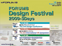
FORUM8 held "FORUM8 Design Festival 2009 - 3 Days" from November
18th to 20th, 2009 at Tokyo Conference Center Shinagawa. We integrated
"Design Conference", "the International VR Symposium",
and "3D VR Simulation Contest" which had been held separately
in two events before, into a festival with a new concept. |
 |
In 2009, we released "Engineer's Studio", 3 dimensional (3D)
plate dynamic nonlinear analysis program, and "VR-Studio", VR
system that supports large-scale and multifunctional projects, both of
which we had been developing as new flagship products of each series. As
the year of 2009 was a memorable year for us, we decided to introduce these
new solutions as well as our latest technologies and the related research
movements in and outside Japan on a larger scale.
As the first attempt, this year's Design Festival comprised 3 days: [Day1]
included <Design/Analysis>, <Architecture/BIM>, and <Water
Engineering> sessions of "the 3rd Design Conference"; [Day
2] included the rest the sessions of the Conference <CAD & VR>
and <Technical Support>, and "the 3rd International VR Symposium";
and [Day 3] included "the 8th 3D VR Simulation Contest".
We report the Design Festival in a serial; the previous issue (Vol. 83)
reported Day 1 & 3, and this issue (Vol. 84) focuses on Day 2. |
| [Day2] The 3rd Design Conference |
For the latter part of the 3rd Design Conference on the 2nd day of the
3-day Design Festival, Main Hall was divided into two rooms, one of which
was used for <CAD & VR> session. <Technical Support> session
was held at the same time in still another room, where the development
staff and engineers of FORUM8 were stationed all the time. They responded
to various questions and demands from the users of UC-1/UC-win products
and our solutions.
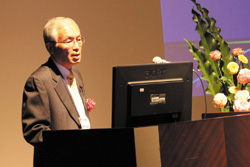
This session was opened up by Mr. Junichi Yamashita, Vice Chair, IAI Japan
Chapter. He delivered Special Lecture entitled "Build Live Tokyo 2009,
a Live Building Design Competition, and Innovation of Design and Production
Process". He talked about IAI's international efforts to promote standardization
of 3D building models for the purpose of mutual operation through data
sharing. He also presented as a part of this "Build Live Tokyo 2009"
that published the situation of participating teams to implement BIM (building
information modeling) while collaborating on the Internet in real time.
Then he explained the context of why BIM was required, the influences that
BIM has on building design and production processes and so on.
 Mr. Junichi Yamashita, Vice Chair, IAI Japan Chapter Mr. Junichi Yamashita, Vice Chair, IAI Japan Chapter |
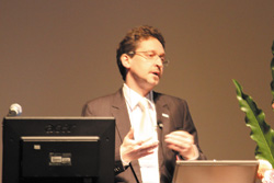
The next special lecture comprised two parts. The first part, "Announcement
of Allplan (Engineering) Japanese Version", was delivered by Mr. Sven
Elbl, Director of Product Management, Nemetschek Allplan Gmbh (Germany).
After introducing the overview of Nemetschek company and its Allplan family
products, he explained improvement in productivity by 3D reinforcement
based on BIM with case studies. The latter part the lecture was entitled
"Case Study of Allplan in Civil Engineering Field in Korea" given
by Mr. Chris Kim, Senior Manager of Basissoft Inc., Korea, discussing what
is BIM, Allplan as BIM software, and its advantages and examples.
 Mr. Sven Elbl, Nemetschek Allplan Gmbh, Germany Mr. Sven Elbl, Nemetschek Allplan Gmbh, Germany |
|
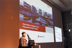
 Mr. Chris Kim, Basissoft Inc., Korea Mr. Chris Kim, Basissoft Inc., Korea |
The last special lecture in the morning was "Integrated Construction
Process by Graitec from Modeling to Design" by Mr. Alexandre Tartas,
COO, Graitec France. With an eye on various issues in the 21st century
including environment and energy, he talked about responses that the construction
industry is required to give, different BIM solutions offered by Graitec
in relation to them, and specific approaches to improving productivity
through one of these solutions, Advance Steel.
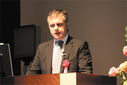
 Mr. Alexandre Tartas, COO, Graitec France Mr. Alexandre Tartas, COO, Graitec France |
The first presentation of the latter part of the session was made in two
parts, each by our staff. Entitled "VR-Studio?", "UC-win/Road
Ver.4", the staff made a presentation of the latest information about
UC-win/Road. He explained the main features and basic functions of VR-studio,
its functions under development, new functions of UC-win/Road Ver.4 and
its functions under development. The second part, entitled "The Latest
Cases of VR System Development and Our Proposal", introduced examples
of setting up the 3D stereo view system, MR (mixed reality) / AR (augmented
reality) system, different drive simulators (DS), and their application
systems.
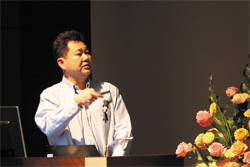
 Prof. Shigenori Tanaka, Faculty of Informatics, Kansai University Prof. Shigenori Tanaka, Faculty of Informatics, Kansai University |
Then, Prof. Shigenori Tanaka, Faculty of Informatics, Kansai University
gave Special Lecture "Development of Made-in-Japan 3 Dimensional CAD
Engine". He mentioned about "SXF", standard foundation for
2-dimensional CAD data exchange and said that specifications for SXF is
fixed and that some software programs that support it have been provided
so far. He further focused on the present situation that there is no low-cost
general-purpose 3 dimensional CAD offered in the field of construction
leading to little progress in use. He then described the idea of developing
"Made-in-Japan 3 Dimensional CAD Engine designed for the construction
field", and its core project named "Kansai University Kaiser
Project" the entire overview of the 3-D CAD Engine, and its future
vision.
To see the full text of the article, visit
http://www.forum8.co.jp/english/fair-e-3.htm#Day2 |
| [Day2] The 3rd International VR Symposium "New Age VR Simulation" |
VR-related Technologies Progressing in Architecture and Construction Fields
in the World: The Latest Research that Draws Attention by the International
Academic Group that Expanded in the 2nd Term
Another event of "FORUM8 Design Festival 2009-3days" day 2 (November
19, 2009), "the 3rd International VR Symposium" was held in the
room next to Design Conference in the Large Hall, Tokyo Conference Center
Shinagawa.
FORUM8 released the large-scale multi-VR "VR-Studio" in October
2009 as a new strategic VR product, and the latest version of the conventional
product "UC-win/Road Ver.4" in December. This symposium linked
the meantime, showing emerging directions and possibilities in wide-ranging
areas related mainly to building and construction as well as to urban development,
transport, and energy. |
 |
To see the full text of the article, visit
http://www.forum8.co.jp/english/fair-e-3.htm#3VRsymposium |
| Presentations by "World 16" |
Dr. Yoshihiro Kobayashi, who has been leading the activities of World 8
from its start as a representative, chaired the presentations of "World
16" in the afternoon.
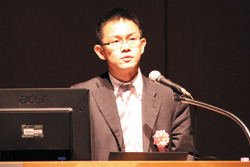
Prof. Tomohiro Fukuda, Associate Professor of Environmental Design &
Information Technology, Division of Sustainable Energy & Environmental
Engineering, Graduate School of Engineering, Osaka University made the
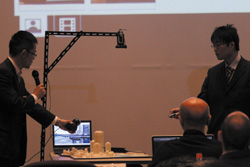
first presentation of "World 16", entitled "Development
of a City Presentation Method by Linking a Viewpoint Between Physical Model
and VR". He developed a mechanism of linking a 1/300 scale physical
model of Nakanoshima with VR model, Osaka, pointing the physical model
with a laser pointer, having a sensor to read it and displaying in VR.
He introduced the system of connecting advantages of a physical model and
VR while demonstrating the prototype.
 |
|
 |
 Associate Prof. Tomohiro Fukuda, Environmental Design & Information
Technology, Graduate School of Engineering, Osaka University Associate Prof. Tomohiro Fukuda, Environmental Design & Information
Technology, Graduate School of Engineering, Osaka University |
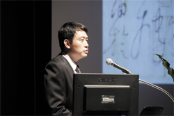
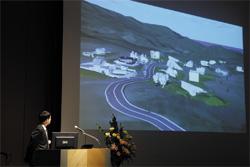
A group project by several researchers in Taiwan, "Next-GENE of Virtual
World" was presented by Prof. Sheng-Cheng Shih, Assistant Professor,
Department of Digital Design, MingDao University on behalf of the group.
In the project of designing houses with more than 20 architects in and
out of Taiwan participating, they created simulation of villages and traffic,
and representation of buildings, in VR environment built up with UC-win/Road
for proposing a house design imitating calligraphy. He said that the effectiveness
of VR was accepted.
 |
|
 |
 Assistant Prof. Sheng-Cheng Shin, Department of Digital Design, MingDao
University Assistant Prof. Sheng-Cheng Shin, Department of Digital Design, MingDao
University |
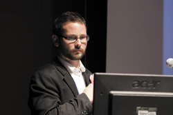
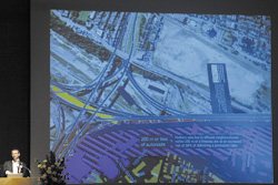
Prof. Michael Jemtrud, Associate Professor of Architecture, Director, School
of Architecture, McGill University made a presentation "VR Model of
Repair Improvement of Turcotte Highway Interchange". He used UC-win/Road
for creating a platform to build consensus among state and city governments
and stakeholders across various areas in rehabilitating an important interchange
in Montreal. Setting up three scales for the city scale, view from the
road, and neighborhood / human scales, he introduced animation as a product
of visualization by inputting all the required information. He also mentioned
the next step.
 |
|
 |
 Associate Prof. Michael Jemtrud, Director, School of Architecture, McGill
University Associate Prof. Michael Jemtrud, Director, School of Architecture, McGill
University |
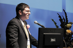
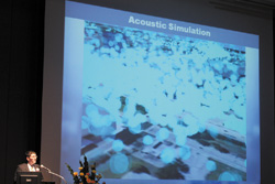
Research Scientist Matthew Swarts, College of Architecture, Georgia Institute
of Technology, made a presentation of a group project by several researchers
in the U.S. "Noise Analysis and Combined Form of Highway Bridge in
Orlando" on behalf of the group. This is a research project with focus
on redevelopment of the Bridge District along I-4 in the downtown of Orlando.
He talked about the process of creating 3D models based on various pieces
of information about the site collected by the group researchers and their
students, importing them into UC-win/Road, and performing different traffic
simulations. He also mentioned their efforts such as visualizing noises
through the products.
 |
|
 |
 Research Scientist Matthew Swarts, College of Architecture, Georgia Institute
of Technology Research Scientist Matthew Swarts, College of Architecture, Georgia Institute
of Technology |
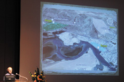
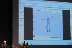
Next presentation was also made for a group project "VR Model of Reproduction
of Historic Streets in 18th Century in UAE". First, Prof. Ronald Hawker,
Associate Professor, Department of Art & Design, College of Arts &
Sciences, Dubai Campus, Zayed University, UAE introduced their activities
for the historical areas in the north-east part of UAE including Ras al-Khaimah,
e.g. creating 3D models from pieces of information on the areas with UC-win/Road
and applying them to various research. Then Prof. Thomas Tucker, Assistant
Professor, Department of Fine Arts, Winston Salem State University in the
U.S. explained the process of creating models from a technological aspect.
In addition, a student who performed actual operation talked in the video
about more detailed technique.
 |
|
 |
 Associate Prof. Ronald Hawker, Department of Art & Design, College
of Arts & Sciences, Dubai Campus, Zayed University Associate Prof. Ronald Hawker, Department of Art & Design, College
of Arts & Sciences, Dubai Campus, Zayed University |
|
 Assistant Prof. Thomas Tucker, Department of Fine Arts, Winston Salem State
University Assistant Prof. Thomas Tucker, Department of Fine Arts, Winston Salem State
University |
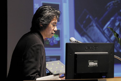
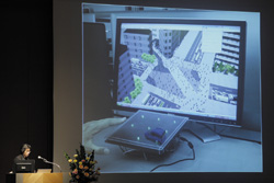
Speakers from Graduate School of Harvard University made next presentations.
First, Mr. Taro Narahara, Doctor of Design Student, Graduate School of
Design, Harvard University spoke under the title of "Development of
Linking System for VR and Interactive Devices" While he reviewed his
work including visualization of human behavior models, he mentioned a project
in which he introduced actions captured from real people into motions of
figures, and represented more realistic figures on UC-win/Road. This time,
he explained the mechanism that enabled real-time interaction by linking
simulation and UC-win/Road on a real time basis through joint development
of plug-ins with FORUM8. He showed his expectation towards a new possibility
that the mechanism would bring about.
 |
|
 |
 Mr. Taro Narahara, Doctor of Design Student, Graduate School of Design,
Harvard University Mr. Taro Narahara, Doctor of Design Student, Graduate School of Design,
Harvard University |
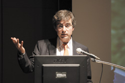
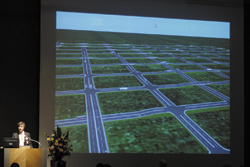
Then Prof. Kostas Terzidis, Associate Professor of Architecture, Graduate
School of Design, Harvard Univ. discussed the design approach of obtaining
a final solution through repeating random search. In the mean time, various
solutions are applied to UC-win/Road, making evaluation while exploring
potentials, and choosing the best one. For optimizing, he explained a procedure
of stratifying problems, performing parallel processing, and displaying
them with UC-win/Road, using examples of simplified shapes, houses, and
a road network.
 |
|
 |
 Associate Prof. Kostas Terzidis, Graduate School of Design, Harvard University Associate Prof. Kostas Terzidis, Graduate School of Design, Harvard University |
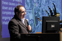
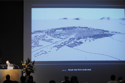
The first speaker after the break was Prof. Paolo Fiamma, Assistant Professor
of Technical Architecture, Civil Engineering Department, University of
Pisa, Italy, who presented on "VR Model Creation of New Development
Plan in Pisa". In terms of the restructuring plan of the area including
historical towns near the Leaning Tower of Pisa, he created 3D models of
the area. Then based on them, he simulated landscape and traffic flow in
the urban area brought about by the plan. With evaluation of the results,
he showed his idea of further promoting their use.
 |
|
 |
 Assistant Prof. Paolo Fiamma, Civil Engineering Department, University
of Pisa Assistant Prof. Paolo Fiamma, Civil Engineering Department, University
of Pisa |
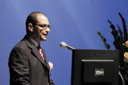
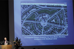
Prof. Wael Abdelhameed, Assistant Professor, College of Engineering, University
of Bahrain, Bahrain / Faculty of fine Arts at Luxor, South Valley University,
Egypt made a presentation on behalf of the group for the group project
"VR Model Creation of Insulation Material and Insulation Effect in
British Houses". When many of buildings of historical value in U.K.
are required to renovate for improving energy efficiency, they are trying
scientific and holistic approach through creating VR with UC-win/Road as
well as microsimulation of construction in regard to various restrictions,
as he discussed.
 |
|
 |
 Assistant Prof. Wael Abdelhameed, College of Engineering, University of
Bahrain Assistant Prof. Wael Abdelhameed, College of Engineering, University of
Bahrain |
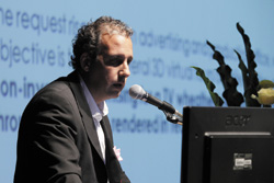
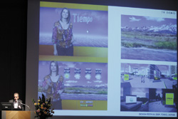
Prof. Claudio Labarca Montoya, Associate Professor, Faculty of Architecture,
Design and Urban Studies, Pontifical Catholic University of Chile presented
a project he is currently working on for a TV program of weather forecasting
under the title of "City Modeling and VR Walk-throughs". This
is a kind of advertisement, representing popular cities among tourists
in all parts of the country in 3D models and providing them on real time
basis. He explained a series of working process and the program structure
in concrete with demonstration. He mentioned that he was using UC-win/Road
for creating base models and such, and also hoping to explore possibility
of utilizing it more continuously.
 |
|
 |
 Associate Prof. Claudio Labarca Montoya, Faculty of Architecture, Design
and Urban Studies, Pontifical Catholic University of Chile Associate Prof. Claudio Labarca Montoya, Faculty of Architecture, Design
and Urban Studies, Pontifical Catholic University of Chile |
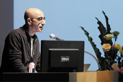
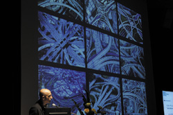
Prof. Marcos Novak, Professor, Media Arts & Technology Graduate Program,
University of California, Santa Barbara presented under the title of "Cities
of Bridges". He first stated that he was just starting to learn about
UC-win/Road, expecting towards the potentials of its diversified functions.
He showed some examples including his attempt to create traffic pattern
on his own, and proposed an approach of using UC-win/Road as a design tool.
 |
|
 |
 Prof. Marcos Novak, Media Arts & Technology Graduate Program, University
of California, Santa Barbara Prof. Marcos Novak, Media Arts & Technology Graduate Program, University
of California, Santa Barbara |
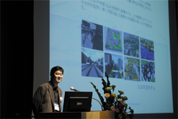
Dr. Yoshihiro Kobayashi, World 16 Chair, made its last presentation. First,
he reviewed the vision of "World 16" project and its activities
over a year, and showed his view that this project has led steadily to
highly qualified result of the research. He further mentioned the project's
new direction of development based on the emerging issues out of the results.
Then he talked about his own study under the title of "Development
of Data Exchange Tool of VR Modeling", explaining the functions and
mechanics of the plug-ins for 3DSMax that was developed this time, as well
as its operation procedure and application examples.
 |
 Dr. Yoshihiro Kobayashi, World 16 Chair Dr. Yoshihiro Kobayashi, World 16 Chair |
|
|
|
|
User Introduction Vol. 84 |
|
|
Using State-of-the-art ICT such as BIM and VR, Isbim Supports Improvement
of Productivity in Construction Based in Hong Kong:
The Company Provides Diverse Solutions for Projects that are Becoming Large-scaled
and Complicated through Virtual Engineering Simulation.
|
While the economic chaos originating from the global financial crisis still
leaves each nation unable to draw a clear roadmap to recovery, Chinese
government is promoting large-scale public projects with its contribution
to world economy in mind. As a part of it, there are some movements of
major projects also in Hong Kong towards providing various social infrastructures.
This issue picks up Isbim Limited (Isbim), a consultant company based in
Hong Kong that provides diverse services using state-of-the-art information
communication technology (ICT) positively including BIM (building information
modeling).
In Hong Kong, it is reportedly said that in implementing projects there
is an increasing need for virtual engineering simulation in order to explain
the construction concept such as construction sequence and method statement
as well as the possibility of their design. Following this tendency, Isbim
paid attention to key technologies such as BIM and VR (virtual reality),
throwing their energy into introducing various tools to realize them more
effectively. In this process, Isbim introduced "UC-win/Road",
FORUM 8's 3D real-time VR software in 2009 for creating VR animation to
explain the construction method described in the method statement. At the
same time, Isbim is active as one of the members making up the network
of FORUM 8's overseas agent network.
This time, we interviewed Mr. Lau Kai Chung (Rex), BIM/VR Engineer at Isbim
who creates VR animation and BIM models using the software.
To see the full text of the article visit http://www.forum8.co.jp/user/user84-e.htm |
 |
|
 |
|
 |
|
 |
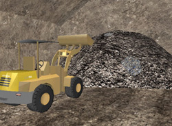
 The excavation. The excavation. |
|
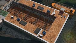
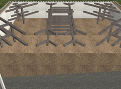
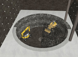
 This project simulates a tunnel work including excavation and injection. This project simulates a tunnel work including excavation and injection. |
|
New Product Introduction
|
|
|
 Overview Overview
The standard feature of the current UC-win/Road allows 4 channel display per PC.
FORUM8 is currently developing UC-win/Road cluster system to increase the
number of display channels. This system can synchronize multiple PCs and
project images to multiple monitors. Increased number of display channels
lead to more effective immersion because of the enlarged projection area.
The system will be ideal for simulators and conference rooms with 360-degrees
cylindrical screen, and control room simulations.
 Features Features
- Easy set up and operation
- Flexible system with no limitations to the number and configuration of
clustered PCs
- All functions of UC-win/Road can be used on clustered configuratios
- Improved performance on clustered system compared with single PC syste
- A variety of simulations are possible in this multipurpose system which
has all elements synchronized
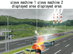 |
 synchronization of flags, fire and smoke, vehicles and snow synchronization of flags, fire and smoke, vehicles and snow |
 Implementing clustered system Implementing clustered system
Multiple PCs are connected via LAN, and one PC calculates the simulation.
The calculation results are sent to the other PCs, which then process the
images to display. In this system, the machine that calculates the simulation
is called "the server" and the machines that receive the calculation
results and process the images are called "slave machines". The
calculation and processing of images are performed as follows.
- Simulation is calculated once for each frame
- After each calculation, the data required is sent to the slave machines
- While the slave machines process these images, the server calculates more
data for the next frame
- The server will send the data for the next one frame, if the calculation
takes less time than the time it takes for the slave machines to process
the image.
This optimization minimizes problems caused by data sending/receiving time.
Multicast IP is utilized to send data to the slave machines, so that it
minimizes the work load at the server and on the network.
- After image processing finishes, the server will perform the next calculation
and data transmission.
In the cluster system, one server machine calculates the simulation and
the slave machines are used solely to process images. Because of the distributed
workload, the performance of the system is improved. The previous versions
of UC-win/Road processed all the calculations except for the traffic in
a single thread, but for this multiple display channel function, the calculation
and the processing had to be performed independently. As a result of optimized
use of multi CPU and multi-core CPU on the standard configuration of the
UC-win/Road, we can see the improved performance of 3D trees, flags, clothes,
fire and smoke and the animation of MD3 characters.
The data, which server sends to the slave machines, are the information
and attributes of moving elements. Each slave machine processes images
after receiving data to update the 3D space. When visualizing 3D trees,
flags, rain and snow, the processing becomes more complicated, thus, the
data becomes larger, and therefore, high speed data transmission over a
network becomes nearly impossible. Hence, to process of these objects,
server sends minimum parameters for the calculation and the slave machines
processes the calculation.
 Functions Functions
As the functions for the cluster system was added with the standard version
of UC-win/Road as the basis, the system has all the features of the standard
UC-win/Road. To minimize operations on the slave machines, all the operations
except for the initial settings can be done on the server machine. At the
time of simulation, operation is done by server machine and visualization
is done by slave machines.
The cluster system is operable only when using the following functions
with following settings.
| Initial setting of slaves |
slave machine name, network address of server |
| Server |
Area displayed by slave machines |
| Disconnect slave machines |
| Restart, shut down and data import of slave machines |
| Switching to server/ standard mode or automatic start of server mode |
| Simulation start/ end |
 Performance benchmark Performance benchmark
We measured the level of performance to check the validity of this system.
We found that its performance improved, in comparison with the standard
UC-win/Road system, and that the number of clustered PC does not affect
the performance. In addition, by comparing 4-channel clustered configuration
with the standard configuration, we saw the improvement of 140%. By comparing
15 slave machines and standard 1 channel, we saw the improvement of 20
%.
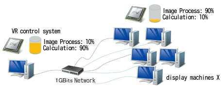 |
 cluster configuration, how to process separately cluster configuration, how to process separately |
 Future development Future development
The basic function of the cluster system is to realize synchronized display
of one virtual reality environment on multiple PCs. The function improves
the sense of immersion and the system is applicable to other usage than
the improved sense of immersion. For example, single image of VR is broadcasted
to a number of people taking part in driving simulation in the same VR
environment is done, taking the interaction with other people into account. |
|
 Preface Preface
As one of the applications of 3D information in surveying and construction
field, 3D modeling of point cloud data, which is surveyed on site by using
high accuracy GPS-based mobile measuring device, is drawing attention.
In a FORUM8-conducted sample project, we used the data from Umi-hotaru
(sea firefly) parking area along the Tokyo Bay Aqua Line Expressway measured
using Mitsubishi Mobile Mapping System (MMS). In this page, we are going
to update you with the latest information on Point Cloud Data Plug-in option
which can import point cloud data into UC-win/Road.
 Sample project Sample project
Umi-hotaru is an artificial island along the Tokyo Bay Aqua Line Expressway.
Its complex structure, consisting of flyover ramps, a tunnel, a bridge
and a parking space, makes this structure a perfect example to illustrate
the benefits and setbacks. In this project, a VR model of the structure
was successfully produced after minor adjustments using a conventional
modeling tool.
- Data file (In case of Umihotaru, an excel file which has 17,000,000 coordinates)
- File format: X-coordinate, Y-coordinate, Z-coordinate (Height), R value,
G value, B value
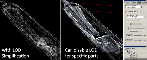 |
 adjustment with VR Mesh Reverse adjustment with VR Mesh Reverse |
Benefits and setbacks of using "point cloud" data
Advantage
- Accurately measure objects and roads in full 3D
- Makes it easier to understand the project
- The perfect way to validate data.
- Use in conjunction with CAD and Google Earth Measurement
Disadvantage
- More time consming
- Extra training may be necessary
- PC with larger capacity may be required
|
 Point Cloud Data Plug-in option Point Cloud Data Plug-in option
| As well as the import of point cloud data, Point Cloud Data Plug-in option
has many more features. This option enables you to import point cloud data
obtained using surveying tools, such as laser scanner, into the 3D VR software
and display the imported data at a specified position. To convert the terrain
data, TIN data is generated from the laser-scanned point cloud data and
then terrain patch function can be used to model the terrain. Repositioning
of the point cloud data is possible by moving the point clouds sideways
or rotating them. For exporting data, you can export point cloud data to
Land XML data, so that the generated data can be used on other systems. |
|
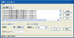
 Point Cloud Data Plug-in window Point Cloud Data Plug-in window |
 |
|
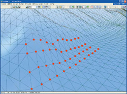 |
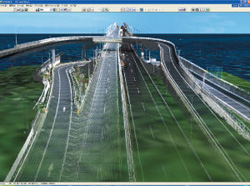
 Screen shot of imported point cloud data Screen shot of imported point cloud data |
|
 generation of terrain TIN data, terrain modeling generation of terrain TIN data, terrain modeling |
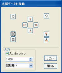 |
 position adjustment of point cloud data position adjustment of point cloud data |
| N,S,E,W buttons |
: |
to move in the direction of North, South, East or West |
| UP,DN buttons |
: |
to move up or down |
| Rotation button |
: |
to rotate around the rotation axis |
 The application examples of "point-cloud" data The application examples of "point-cloud" data
- Use as reference points when creating roads in UC-win/Road
It can be used in combination with Mobile Mapping System as a processing
tool or a VR modeling tool
- Use for reverse analysis in VR model of UC-win/Road
"Point-cloud" data can be used for validation of VR model. For
example, it can be used to ensure accuracy when creating VR data, and also
for aging and deterioration diagnosis and differential analysis.
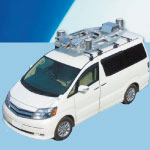
 Mitsubishi Mobile Mapping System (MMS) Mitsubishi Mobile Mapping System (MMS)
- MMS is a High Precision Mobile GPS Measuring Device. Locate the position
of objects using laser scanner and camera to create a highly accurate 3D
map of an urban area.
- MMS is equipped with three GPS aerials, an IMU, cameras and laser scanners
on the roof of the vehicle, and three DPS placed in triangle captures the
vehicle movement very accurately.
- With 100usec resolution, the accuracy of the data collection does not deteriorate
even when travelling at a higher speed. Up to five cameras and five laser
scanners can be connected to the system.
| NEWS |
FORUM8 International Office News |
|
|
<related information> Overseas agency list ĀE Branch & Showroom
 FORUM8 Korean Office Established FORUM8 Korean Office Established
FORUM8 has been setting up offices worldwide, including London LLP (FORUM8
Europe), New Delhi Office and Sydney Office, and FORUM8 Korean Office is
about to join the FORUM8's international network of offices.
UC-win/Road was released in 2000, and in the Korean market, FORUM8 has been working
with our Korean distributor since 2002. There are approximately 50 users
who use UC-win/Road, UC-win/FRAME(3D) and TEMPO series (earth-retaining works) in Korea.
The Korean government is pushing for more construction to take place as
measures to overcome the difficulties that the country is facing in the
current economic climate, and also, there are numerous research projects,
carried out by academics in cooperation with industries. As a result, the
demand for such software solutions as our award-winning 3D VR technology
and our highly-accurate structural analysis is rapidly increasing. The
office in Korea was established to provide more advanced technical support
and dedicated customer care for our Korean customers.
FORUM8 Korean Office is located in Gangnam district in Seoul, which is
one of the busiest commercial districts in Seoul. FORUM8 Korea will set
up a seminar room and hold seminars regularly. Please visit our Korean
Office when you are in Korea.
FORUM8 Korean Office
|
Representative |
: |
Yuk Chang Gil |
|
Address |
: |
12F, Hansin InterValley 24 Bldg., Yeoksam2-dong, Gangnam-gu, 135-918 Seoul,
Korea |
|
E-mail |
: |
yuk@forum8.com |
 |
|
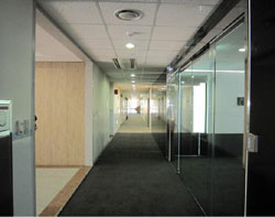 |
 FORUM8 Korean office: the interior FORUM8 Korean office: the interior |
|
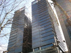
 FORUM8 Korean office: the exterior FORUM8 Korean office: the exterior |
|
|
|

 adjustment with VR Mesh Reverse


