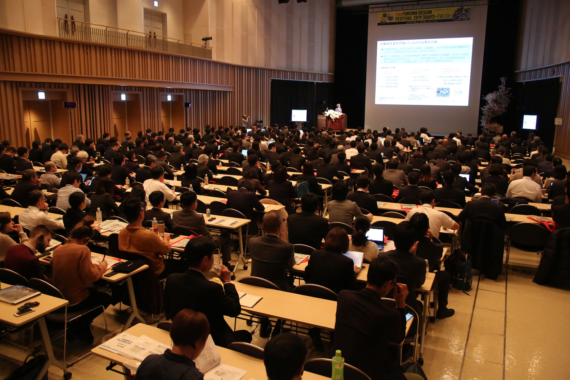
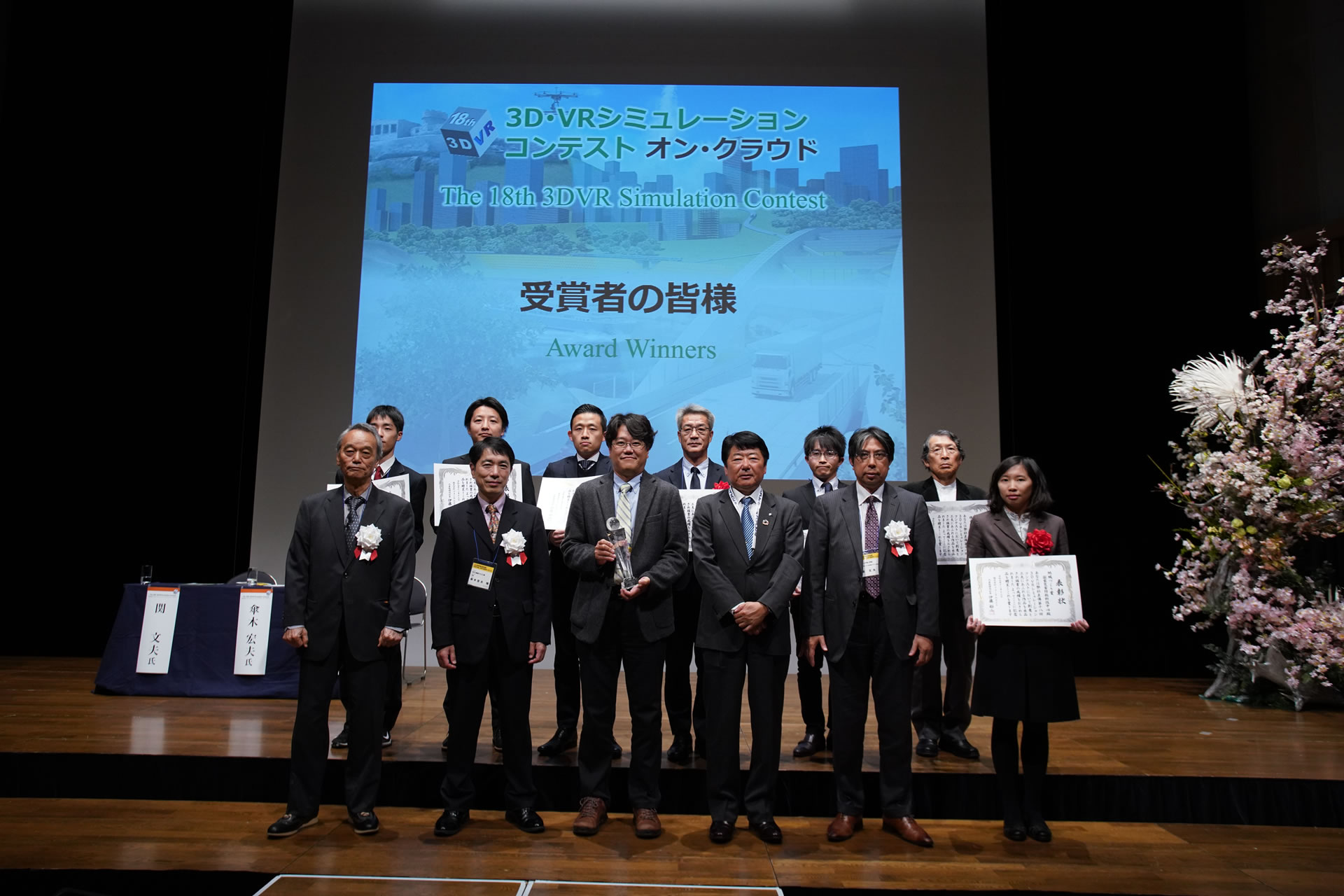
3D/VR Simulation Contest on Cloud starts with the award winning VR Design Studio UC-win/Road software. The main event of the FORUM8 design festival is the competition between international and domestic contestants to see who can create the most advanced VR simulation using VR Design Studio UC-win/Road. A general public online vote has also been implemented since 2011. This year is surely going to be exciting!
Results Announcement
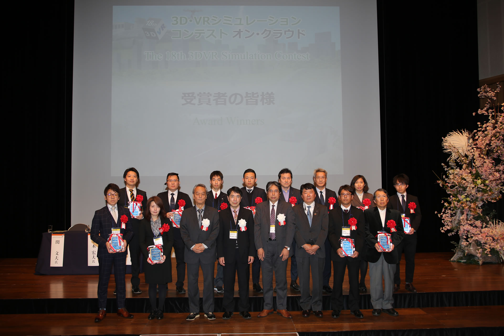
After general voting and careful consideration by juries, Grand Prix, 2nd Prize, Idea Award, Essence Award, and 3 Honorable Judge Award have been decided.
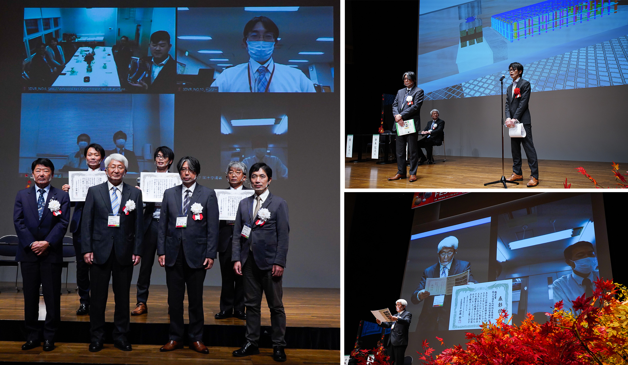
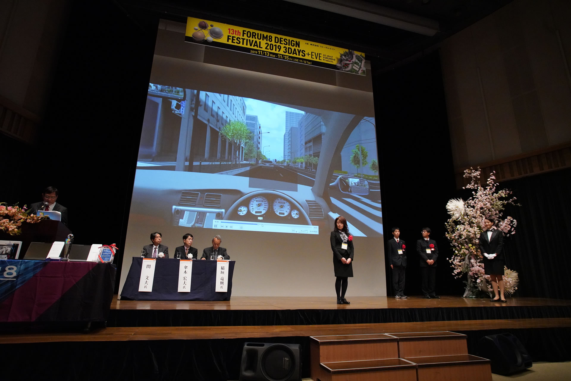
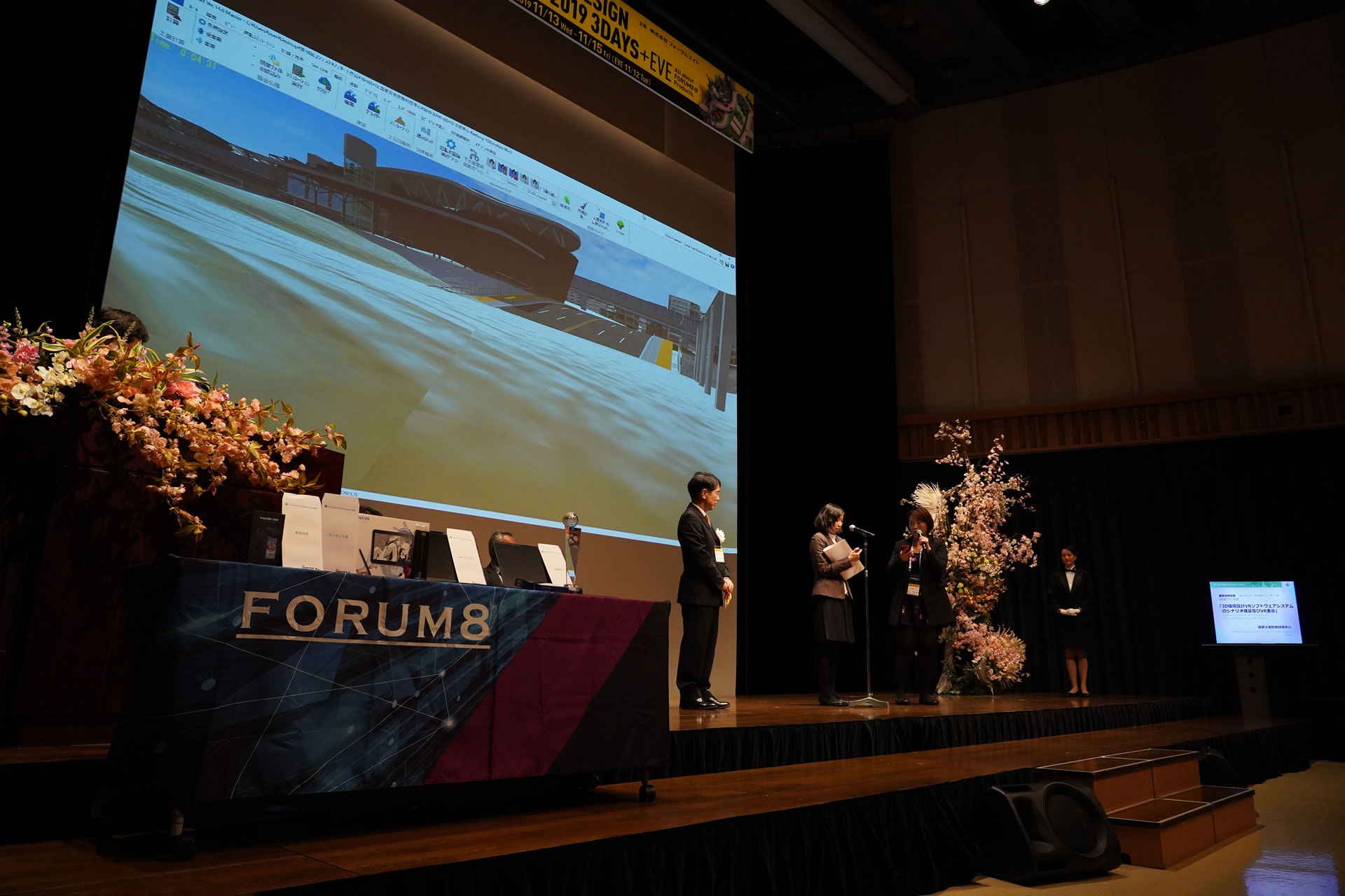
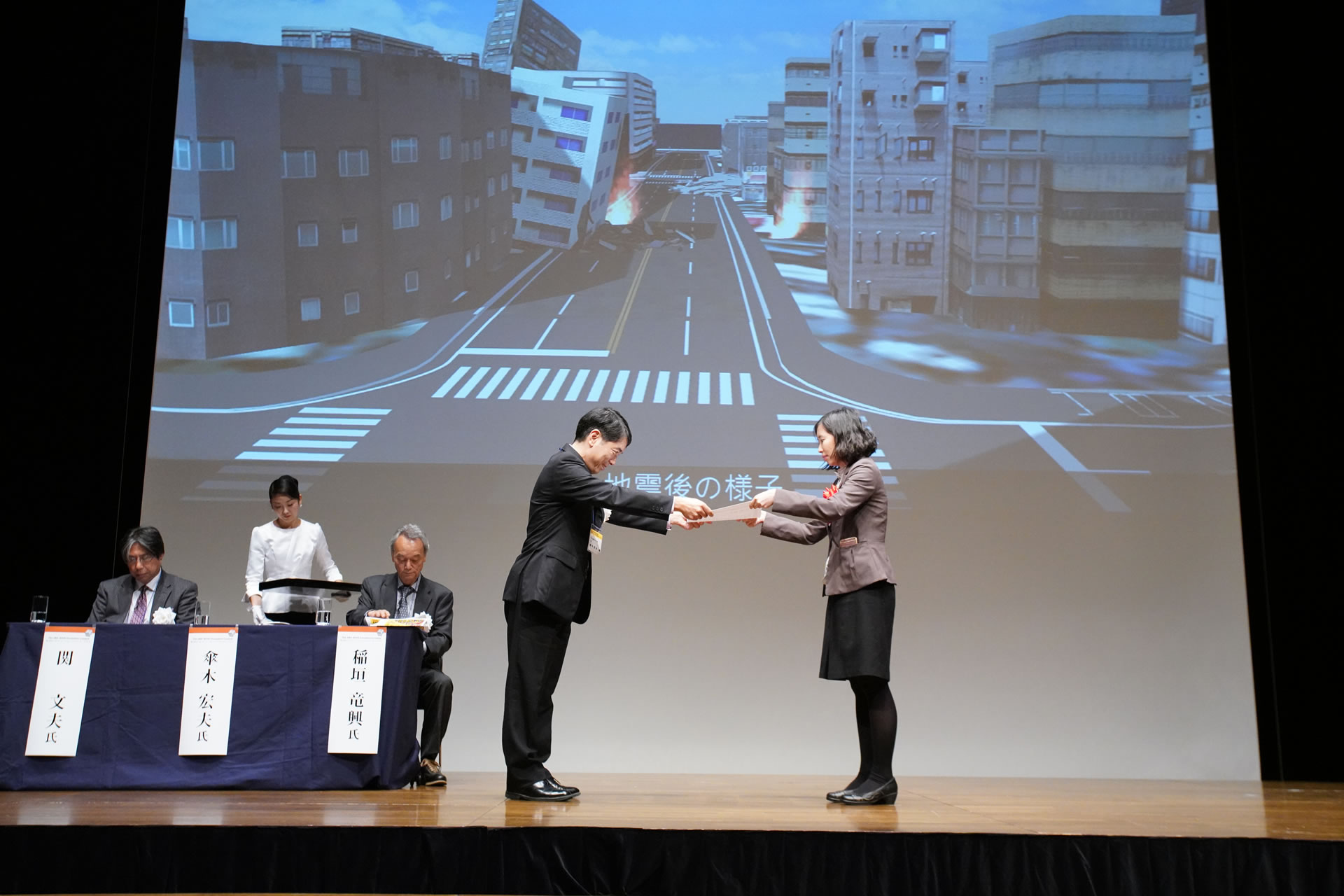
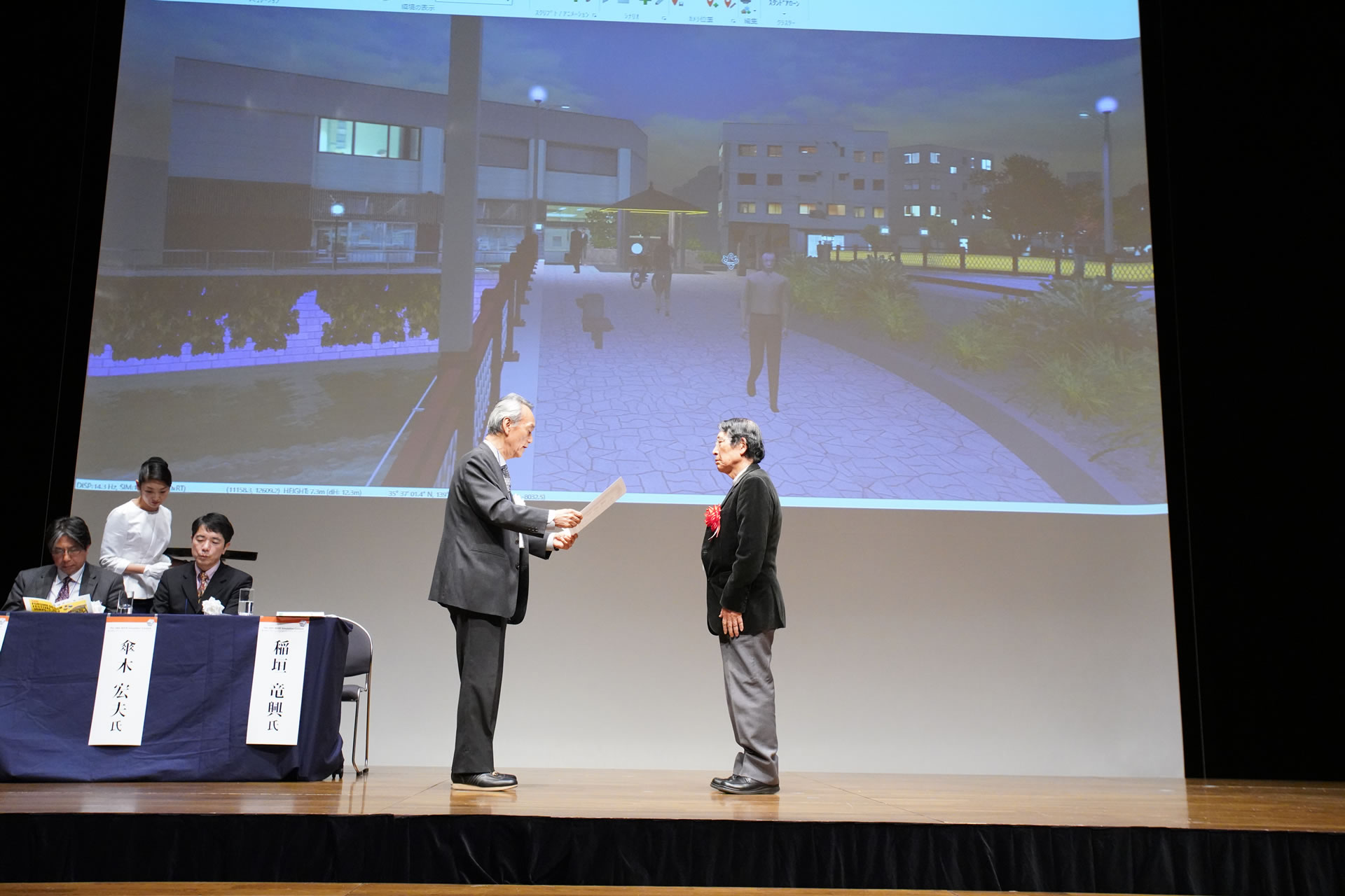
Award Ceremony (Nov. 18th 2020 at Shinagawa Intercity Hall and Online)
Prize-winning works introduction video
-
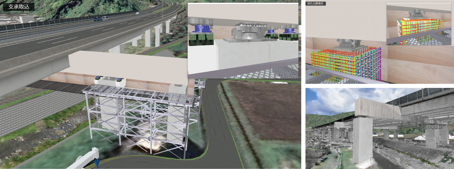
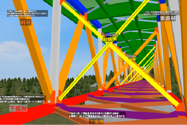
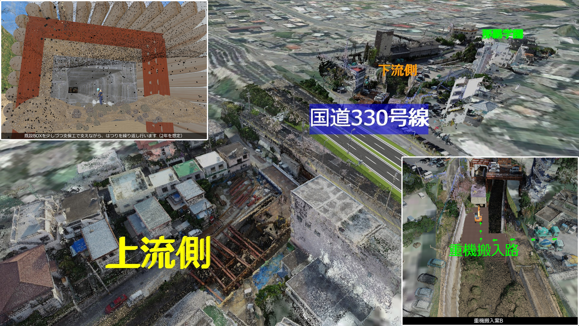
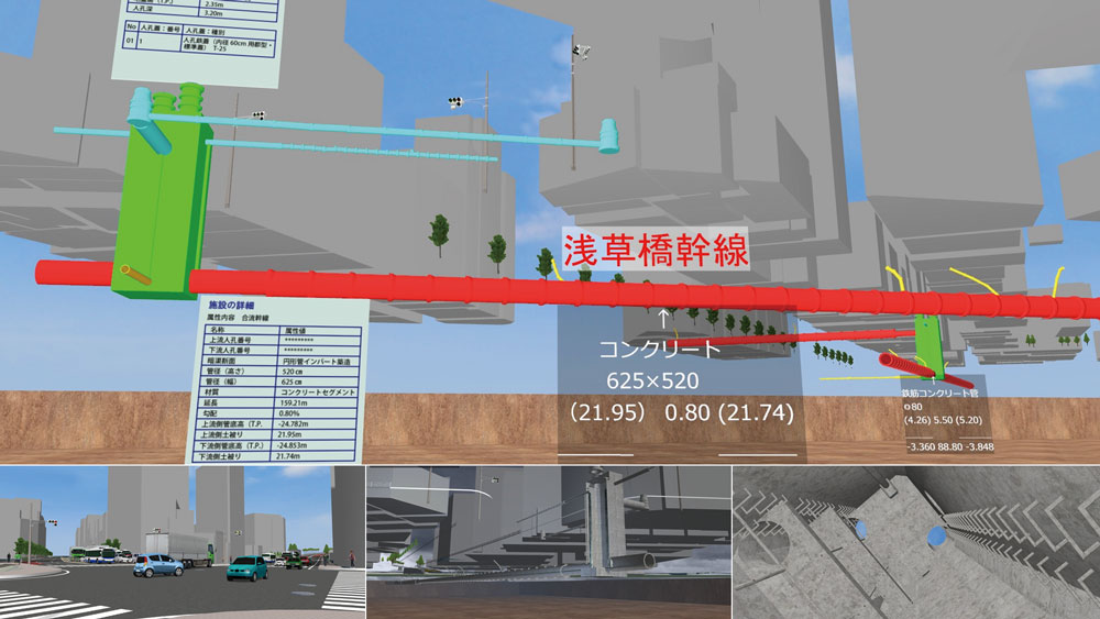
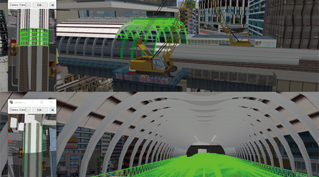
 In order to improve workability, it is important to accurately grasp the on-site situation and reflect it in the plan. This time, we collected point cloud data before the construction work, and modeled the parts accurately from the design drawings to express the on-site conditions. Then we expressed the assumed construction contents and examined the workability.
Watch This!
The animation "概要" scans environments around the construction site and the examples of replacement of bearings. In the scenarios "シナリオ:P4-A~D" and "シナリオ:P5-A~C", viewers can see the details of the construction simulation up close. The simulation is an easy to understand explanation material, showing a series of construction methods in 3D from anchor drilling to chipping. In the animation "クレーン走行", a crane moving along the narrow agricultural road can be checked from both the 3D and 2D view.
-
 2nd Prize (Excellence Award)
Kyushu Technical Office, Kyushu Regional Development Bureau, Ministry of Land, Infrastructure, Transport and Tourism
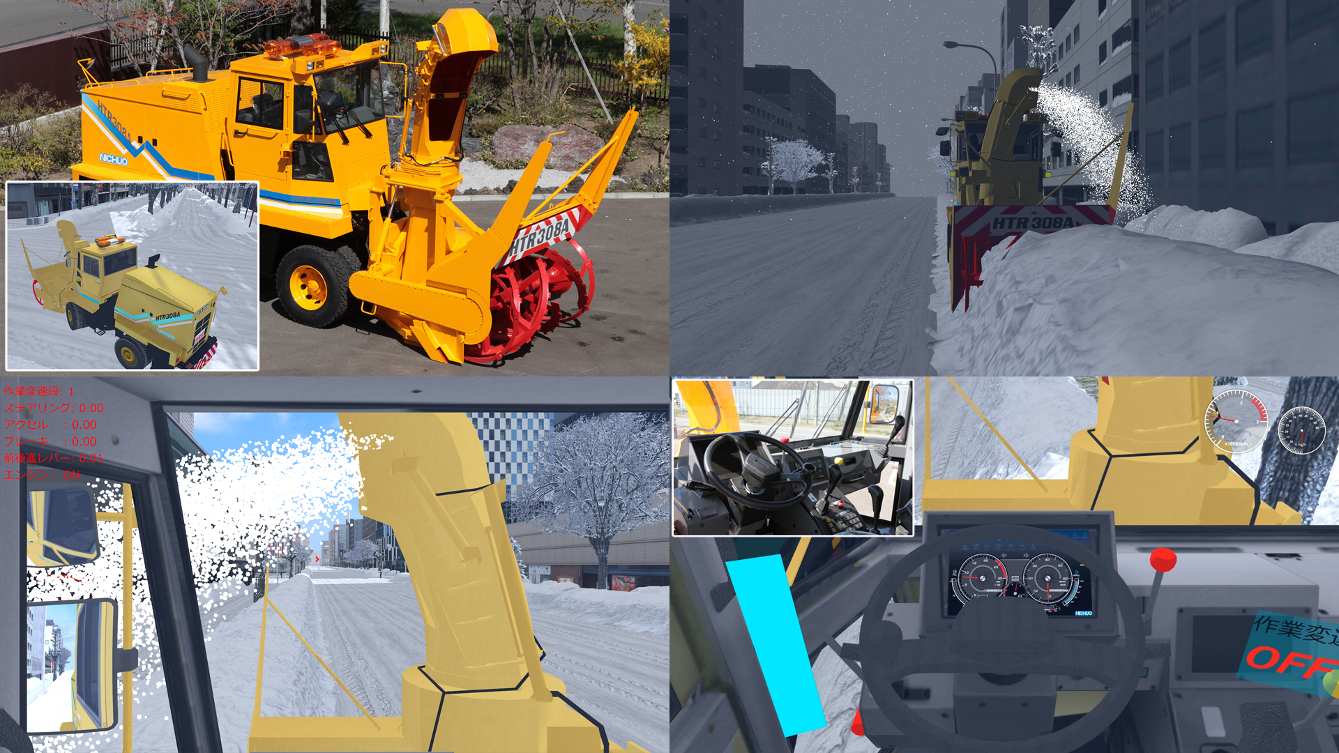
Simulator for remote control training

 Building a reconstruction of the area around Aso Ohashi, which collapsed due to the 2016 Kumamoto earthquake.The photo data is an aerial photograph of the actual disaster site, so that the damages caused at that time can be understood. Using this VR data, we are constructing a remote control training simulator for compact type backhoe for the purpose of initial response in the event of a disaster by connecting a remote operation controller.
Watch This!
By executing the scenario "遠隔操縦訓練概要", viewers can see the operation procedure using the actual equipment, notes in the preparation stage, and the explanation of VR simulation. The scenario "VR走行シーン" shows the operation training. In addition, in the scenario "重機操縦体験" viewers can operate the basic movements of heavy machines and driving in the VR space reproducing the real disaster site.
-

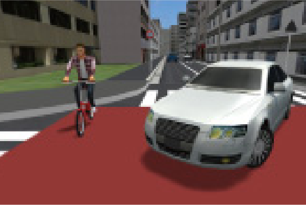
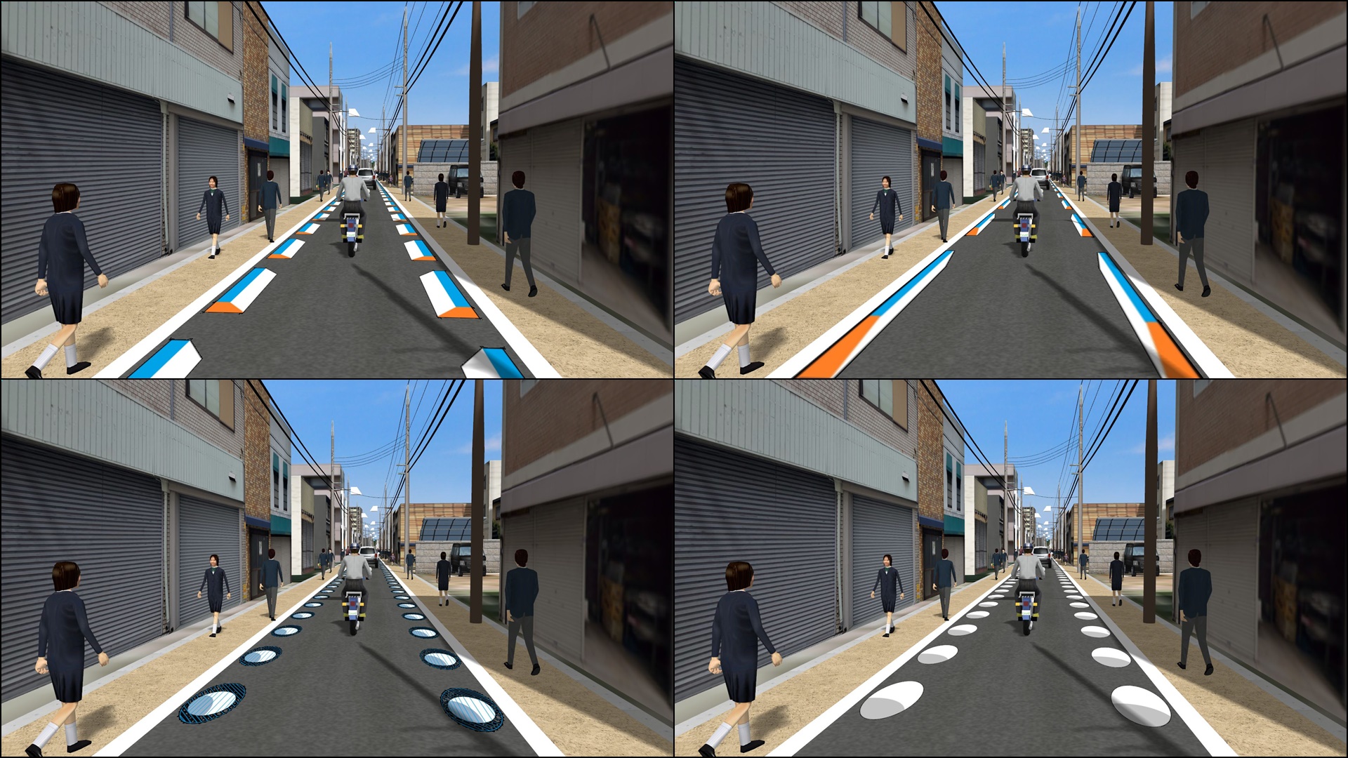
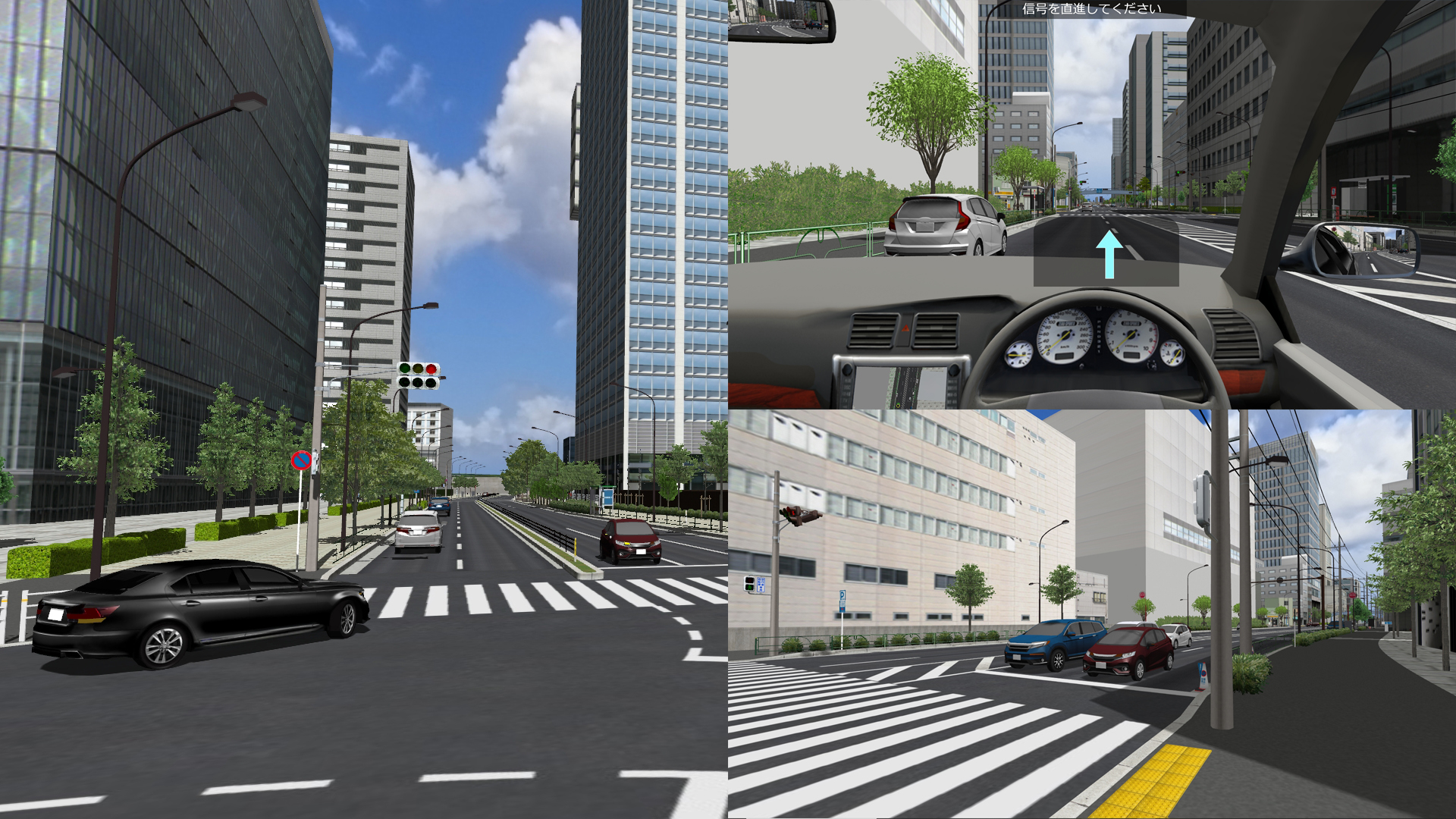
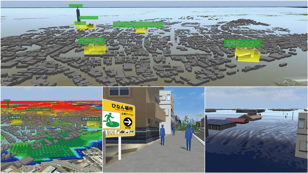
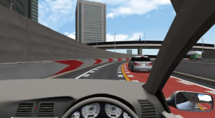
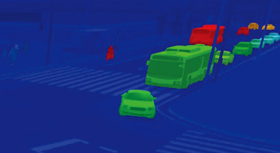
 VR simulation to verify the speed of the driver's reaction to people and bicycles jumping out at intersections while driving a car. By combining a collision-free dummy and a colliding target, about 160 types of various conditions such as the color, size, and timing of the object are set, and the time lag between the driver sensing the danger of collision and the reaction is verified.
Watch This!
This data let viewers experience the scenarios used in the experiments to test the driver's reaction. In the scenario "説明1", viewers can see the purpose, overview, and method of the experiment and experience the experiment events after that. The scenario "セッション1" starts from the testing event including 40 patterns situation. The angle of view setting and interior structure is special-made for the experiment.
-
 Essence Award
Seoul Metropolitan Government Infrastructure Headquarters
Road design for "Changing western highways to urban roads" by VR
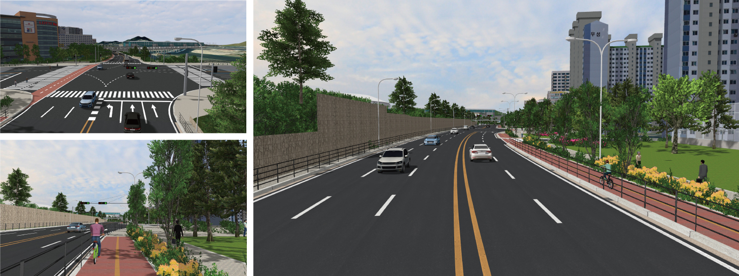
 The city of Seoul is planning to change the western highway to an urban road due to problems such as traffic congestion, environmental pollution, lack of parking lots, and low access rate. In order to solve problems that are difficult to solve with 2D design drawings, we discussed many design issues while checking with UC-win/Road. We review the visibility of intersections, the width of bicycle roads, and the visibility of structures and sound insulation walls.
Watch This!
By executing the animation "Flight View", you can see the improved western highway while flying all the way. In "Driver View", you can see the image of the road structure and landscape from the driver's viewpoint by driving in a typical section. In addition, by executing "Plan", you can check the contents of the discussions, comparison of images before and after improvement, driving image, etc.
-
Honorable Judge Award Public design Award (Mr. Fumio Seki)
Sakaiminato City
A complex facility like a plaza where everyone
gathers Sakakiminato Civic Center (provisional name)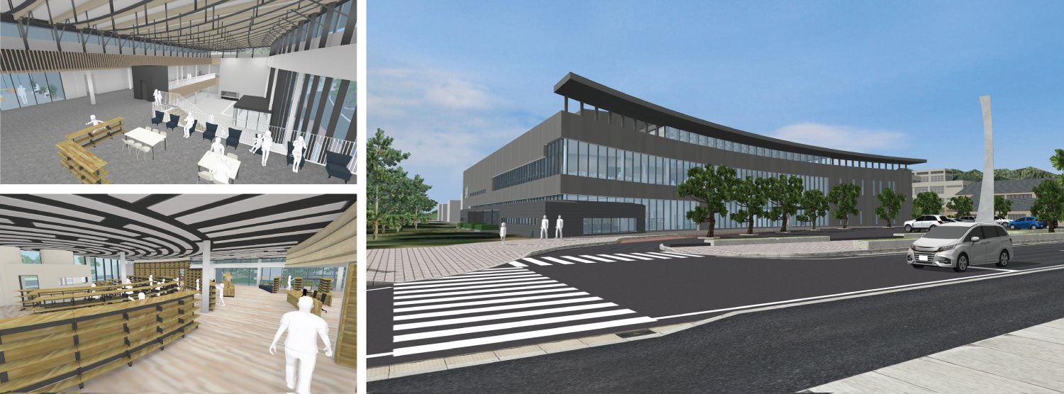
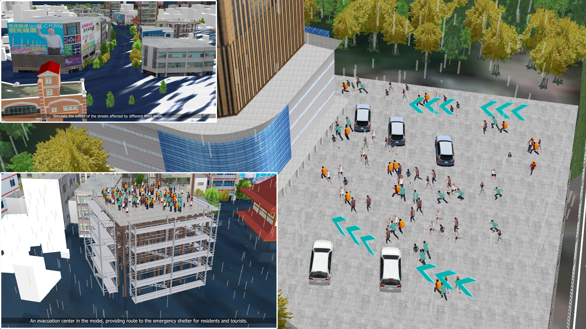
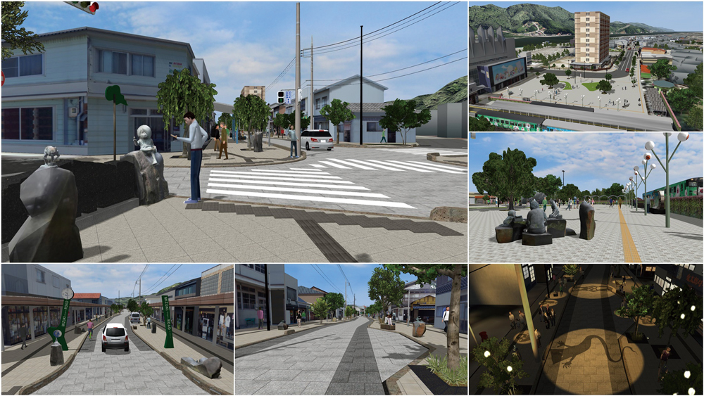
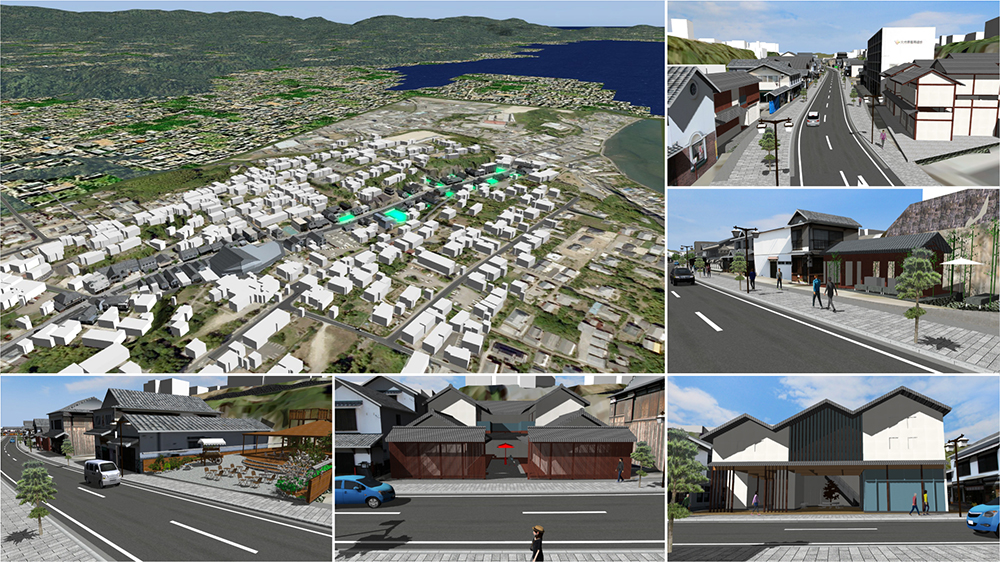
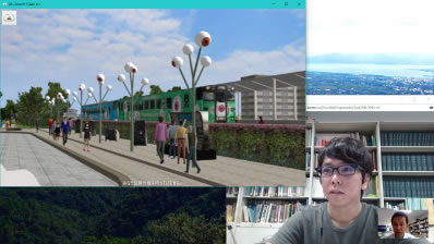
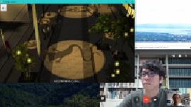
 New construction of Sakakiminato Civic Center (provisional name) is underway. It's a complex facility with a hall, a library community plaza, and a conference room with an art exhibition function, etc. The front entrance of the building has the image of a gentle curve on the Yumigahama Peninsula. It is a multifunctional facility equipped with a place for citizens to interact, a base for interaction with the Self-Defense Forces, and a evacuation shelter in the event of a disaster where the hall becomes flat, and we created a VR content to promote it with the sence of presence of the building.
Watch This!
By executing the animation "施設概要", you can see the image of the area such as the location of the facility and the positional relationship with Mizuki Shigeru Road, and the inside of the facility is also expressed in a digest. In addition, if you select "施設ウォークスルー", you can see the inside of the facility in order from the entrance to the hall, and you can experience and enjoy the atmosphere of the facility from the viewpoint of an actual person.
-
Honorable Judge Award Chiikizukuri Award (Community Development Award) (Mr. Hiroo Kasagi)
Mitsui Consultants Co., Ltd.
Examination of effective construction plans in road improvement projects
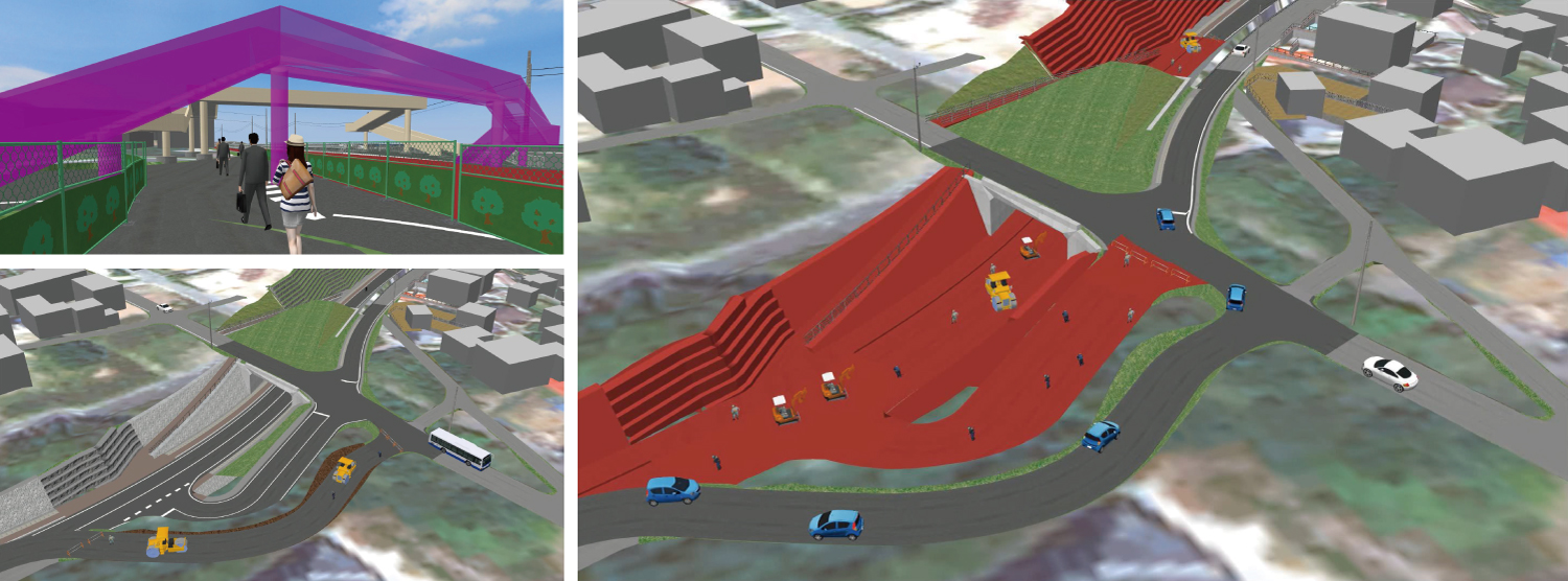
 Introducing test cases using VR technology, which is a part of CIM/BIM, for smooth consensus building with local residents, related national road managers, city road managers, etc. in road improvement projects carried out by the prefecture. As an effect of introducing this technology, many meetings and periods related to coordination have been significantly decreased by half. In the future, smooth business promotion is expected by further utilization of VR.
Watch This!
If you run the animation "道路改良事業における効果的な施工計画検討", you can check the flow of road improvement work in 10 stages. The procedure of road construction and the image of vehicle traffic during construction are expressed in an easy-to-understand manner. You can also check the scenery before and after the construction of the pedestrian bridge, the traffic image and the planned construction of a retaining wall.
-
Honorable Judge Award Traffic simulation Award (Mr. Tetsunori Haraguchi)
IWATA CHIZAKI Inc.
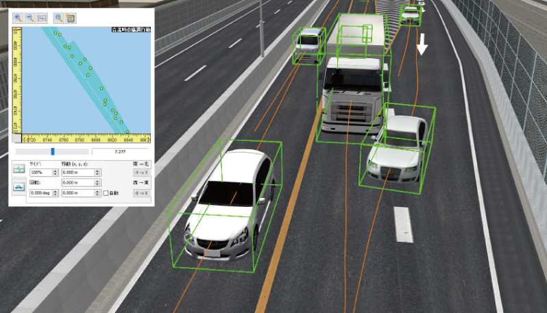
Traffic restriction simulation due to intersection construction in Sapporo
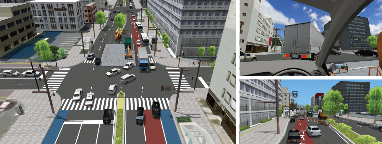
 A traffic simulation was executed to check the affects of traffic restrictions due to construction. Before setting up the restriction zone at the construction site which was near an intersection and at the center of carriageway, the traffic jam at peak times, the congestion of vehicles turning right, and the visibility from drivers were simulated to test the validity of the restrictions. The result was used for the proposal to the clients and users.
Watch This!
When you run the animation "交通シミュレーション", you can see the structure of intersections, the traffic situation, and the traffic simulation comparing normal time and during the planned construction. In addition, by running through the scenario, you can check what a driver's view will look like when waiting behind a vehicle waiting for a right turn.
-
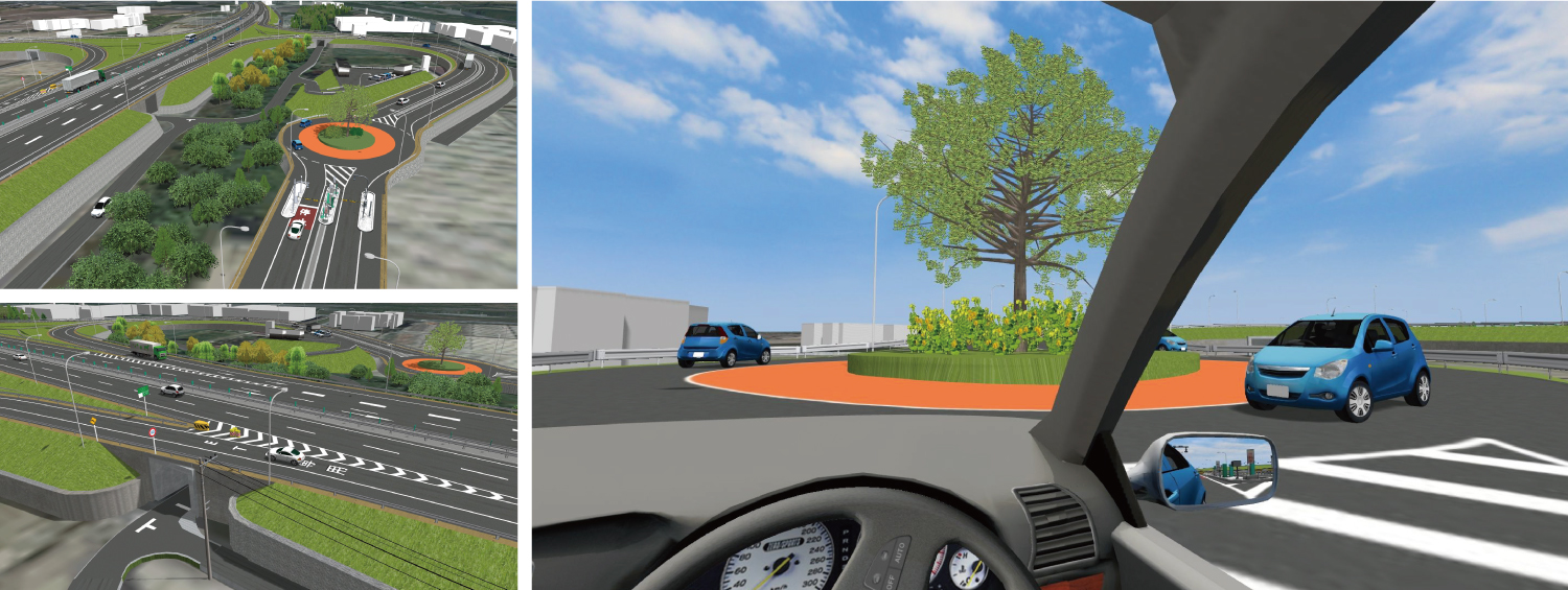 This VR simulation was created to be open on the company's website. The data using UC-win/Road and 3D software includes slopes, box culverts, and roundabouts that can be used in discussions on the outline design. It reproduced a bird view to look down the overall view, and a vehicle without ETC going around the roundabout and returning to the main road.
Watch This!
In this work, the highway main line, the roundabout of the upper and lower lines, and the smart IC are expressed, and you can experience various simulations by executing the scenario "ランプUターン". You can check the overall view, the roundabout, and the viewpoint of the vehicle without ETC that goes around the roundabout from the smart IC and returns to the main line from a bird's-eye view. On both roundabout central islands, aprons and symbol trees are installed with colored pavement, and the contents are designed with consideration for safety and landscape.
-
Nomination Award
Research Institute of Highway Ministry of Transport
Environment simulation assessment on tunnel lighting
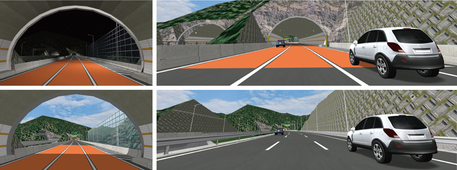 This is a design example of a highway under construction in the mountains of southeastern China. "Gradient design of slope" and "Tunnel design" are depicted in VR, and daylight environment and lighting at night are reproduced in both designs. Driving simulation tests were conducted by also using the real lighting.
Watch This!
If you execute the scenario "シミュレーション評価実験", you can see the representation of the simulator used for the evaluation and the explanation of the experiment method. In addition, by executing the scenario in 8 patterns, you can run the course to be used in the experiment and check the image of the comparison pattern.
-
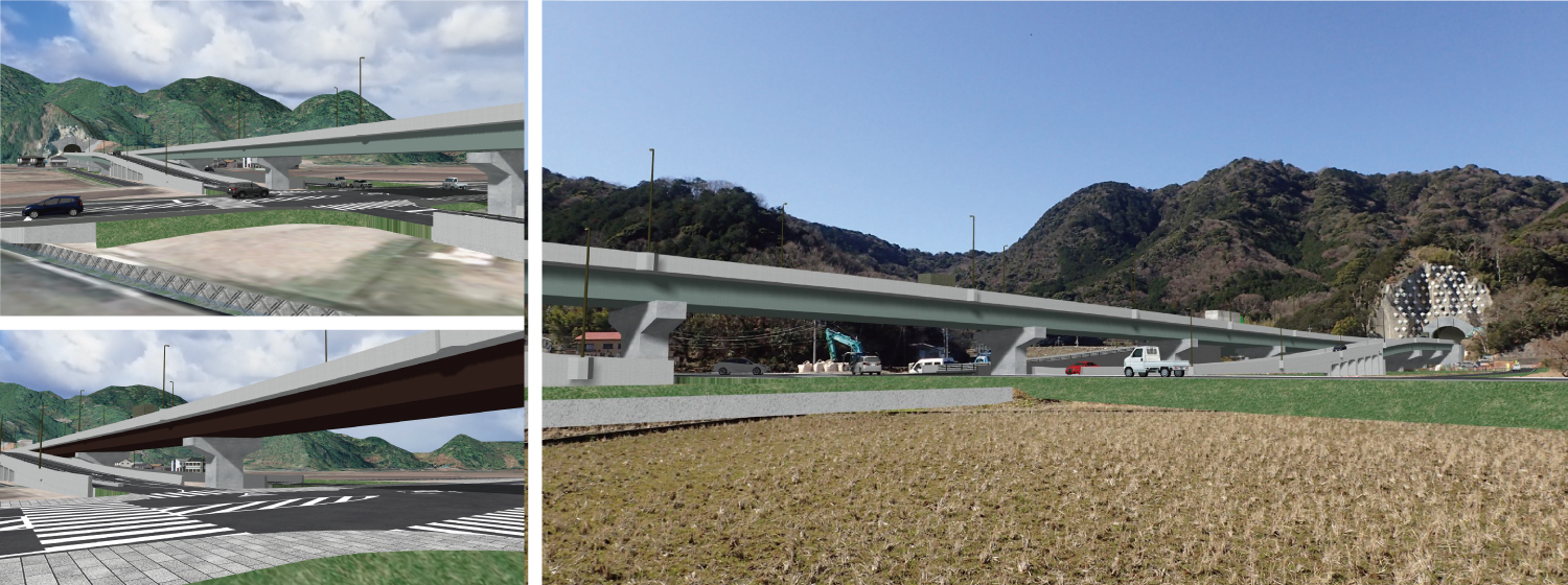 This VR data used as a material for discussion reproduces the Shizuura Bypass under construction on Route 414 in Numazu City, Shizuoka, to check the completed image and the scenery including coloring whithin the viaduct section. Main bridge girders and street lights have 12 color patterns and a final check is created from aerial photos shot by a drone.
Watch This!
By executing the animation "景観検討概要", you can check the color images of the bridge girders and street lights that were actually used in the landscape examination. Twelve types of patterns that combine beige, gray, brown, and green are introduced and can be viewed from various perspectives. Also, if you execute the scenario "フォトモンタージュ写真", you can see the image that combines the VR of the final plan and the landscape photo.


Historical Awards
Every year we explore various fields from civil engineering/construction, to driving/traffic simulations, to even town planning. In arecent years we have noticed a change in an organizations focus to autonomous driving research, disaster prevention scenarios, education, and medical care.
-
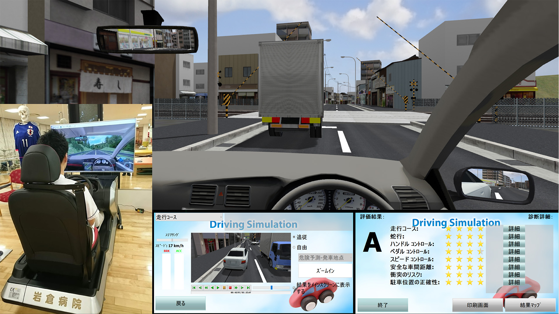
 The planned simulation can be used as a drive training system for patients with higher brain dysfunctions. The data can be gathered and objectively evaluated to see if the person in question is eligible to enter and operate a vehicle. Tests include, speeding checks, stopping in time, and parking in reverse with many more.
 -
18th Semi Grand Prix (Excellence Award)
East Nippon Expressway Company Limited
Using VR as an Experience-based Training System
 VR content that was created with the aim to be used as a training system. Users can learn about highways, bridges, and foundation work. This simulation provides the basic learning for Civil engineering and it is easily viewed in VR allowing for a safe experience-based training system.


-
-
18th Essence Award
Curbside simulation of Honmachi street using a Drive Simulator
-
18th Honorable Judge Award
Hanshin Expressway Company Limited
Hanshin Expressway Vehicle Trajectory Simulation
-
The 18th Honorable Judge Award
National Science and Technology Center for Disaster Reduction
3D Environment Design VR Scenario System
-

Historical Awards
-
-
-

-
16th Idea Award
Limited Association of Pipeline Data Utilization
Combination of 3D models from Pipeline Survey Data
-
-
-
-
15th Honorable Judge Award
Akita Industrial Technology Center / Akita University
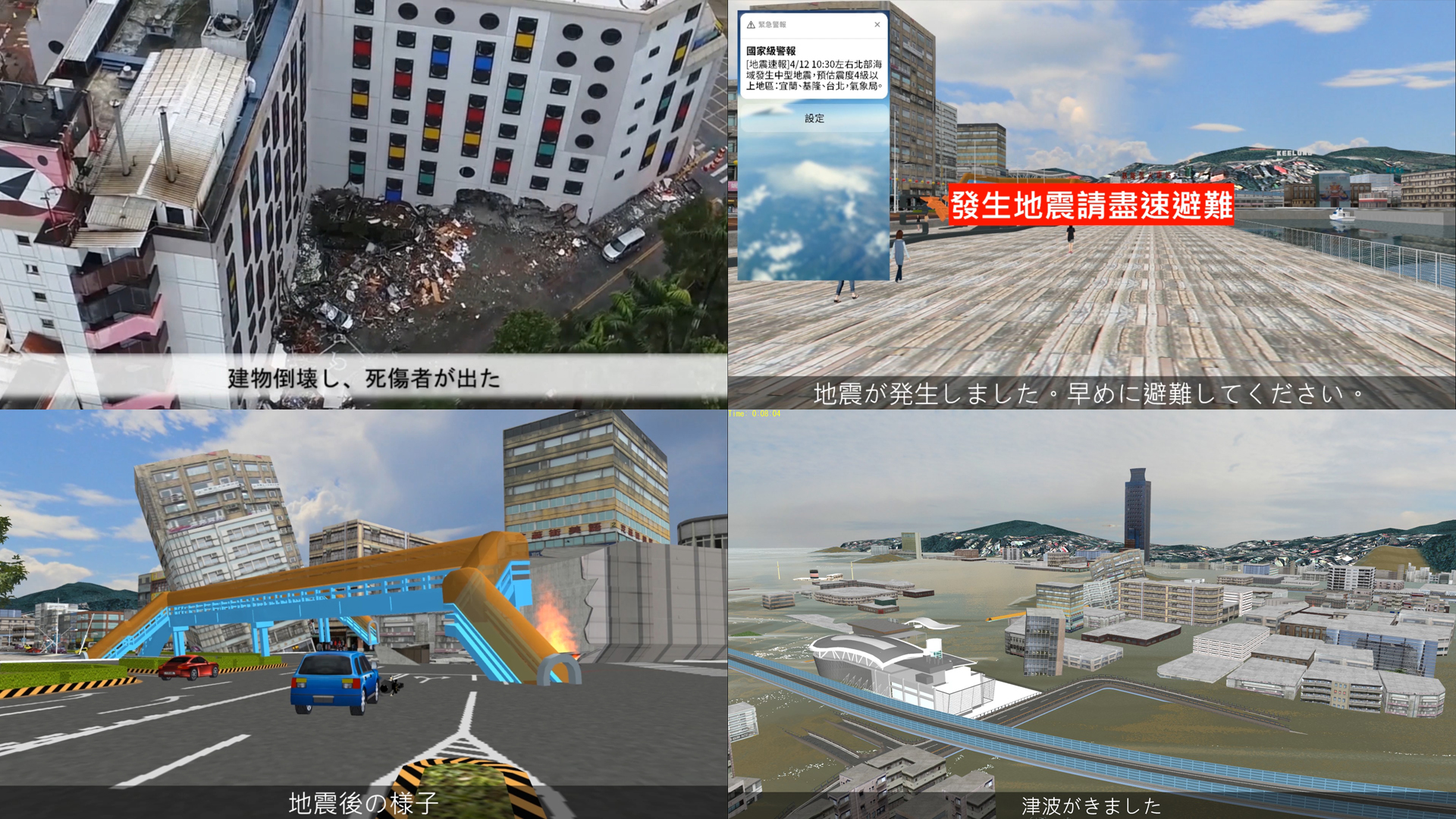
Tsunami Rapid Evacuation Education System
-
-
-
-
9th Honorable Judge Award
Directorate general for Kobe city planning
Consensus building and simulation of Kobe City

Past Contest Information
18th Contest (2019)
17th Contest (2018)
16th Contest (2017)
15th Contest (2016)
14th Contest (2015)
13th Contest (2014)
12th Contest (2013)
11th Contest (2012)
10th Contest (2011)
9th Contest (2010)
8th Contest (2009)
7th Contest (2008)
6th Contest (2007)
5th Contest (2006)
4th Contest (2005)
3rd Contest (2004)
2nd Contest (2003)
1st Contest (2002)
Awards / Prizes

Grand Prix
Trophy, Certificate, Prize (Laptop, SSD, etc.), Gift Card
2nd Prize (Excellence Award)
Certificate, Prize (Laptop, drone, etc.), Gift Card
Idea / Essence Award
Certificate, Prize (Tablet, laptop, etc.), Gift Card
Honorable Judge Award
Certificate, Prize(Action Camera, drone, etc.), Gift Card
Nomination Award
Certificate, Gift Card
* Details of prizes will be posted when they are decided
Overview
Event Schedule
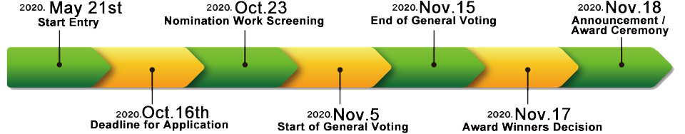
- Deadline for Application
October 16th, 2020 (Friday)
- Nomination Work Screening
October 23rd, 2020 (Friday)
FORUM8 Tokyo Headquarters
- General Voting Period
November 5th to the 15th, 2020
Cloud Voting
- Award Winners Decision
November 17th, 2020
FORUM8 Tokyo HeadquartersUsing a combination of online voting and the judges opinions awards are decided. (Judges 70%, General vote 30%)
- Announcement and Award Ceremony
November 18th, 2020(Wednesday)
Shinagawa Intercity HallFORUM8 Design Festival 2020
The 19th 3D VR Simulation Contest On Cloud Awards Announcement and Ceremony
Judges
-
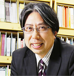
Jury ChairFumio Seki
Professior, Civil Engineering Department
Faculty of Science and Technology, Nihon UnveristyAfter graduting from Nihon University:s Department of Civil Engineering he joined Taisei Corporation. He worked in the Civil Engineering Department Design planning Office. He has been in his current position since 2011.
-

Hiroo Kasagi
NPO Community Development Studio Representative
He is the director of the Environmental Assessment Society, a director of the Institute of Municipal Affairs, a part-time lecturer at Nagano University, a director of Kizakiko Onsen Development Co., Ltd., and a counselor at Omachikita High School. Received the 2005 Minister of the Environment Award for Global Warming Prevention activities.
-
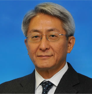
Tetsunori Haraguchi
Visitng Professor, Organization for Future Society Creation,
Nagoya UniversityWorked at Toyota Motor Co., Ltd., and engaged in vehicle product power evaluation through driving. Moved on to the vehicle dynamic performance/chassis technology area until 2002. Next was future vehicle standards and development until 2011, and since 2012 a research at Nagoya University on future Scoiation Creation.
Application Details / Details
- Application Criteria / Submission Conditions
①VR data created through UC-win/Road(5 minute script required)
②Overview of data explainging contents and operation in a brief format
※Data must be on media such as a CD-ROM、DVD format
- Awards
- ■Grand Prix ■Excellence ■Special Awards (Idea/Essence) ■Honorable Judge Award ■Nomination
※No duplicate awards
- Deadline for Application
October 16th, 2020 (Friday)
※Nominees for this event will be decided on October 23rd, 2020 (Friday)
- Destination of Submission
Please tell your contact person of FORUM8 staff and send it to him/her.
- Copyright of Submitted Work
-
The copyright of the VR data of the winning work belongs to the applicant.
Although the submitted data will not be distributed, FORUM8 will edit and process output images, videos, etc. for the data, works and deliverables produced by the author, and will make external presentations, research presentations, sales activities, As a public relations activity, you have a secondary license right such as publication/introduction on media such as HP, public relations magazines, books, magazines and newspapers.
- Inquiries for the application
Please tell your contact person of FORUM8 staff
or e-mail at ist@forum8.co.jp
Product Info
![]()
3D real-time virtual reality software UC-win/Road is an advanced software that can create 3D large-scale space of various projects by simple PC operation and can perform various real-time simulations.
Product Info
- UC-win/Road Ver.15 Ultimate
- USD17,200
- UC-win/Road Ver.15 Driving Sim
- USD11,000
- UC-win/Road Ver.15 Advanced
- USD8,800
- UC-win/Road Ver.15 Standard
- USD6,000
![]()
A consensus building solution that uses 3D/VR on a cloud server. If you have an internet environment, you can operate the VR space with a web browser with any client.
Product Info
VR-Cloud® Ver.6 Collaboration
A full-featured VR cloud system that enables advanced communication between clients and VR. Implementation of shared content management. 3D bulletin board, landscape evaluation, conference support for multiple users. Equipped with annotation and photo functions.
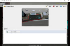
▲Content Viewer
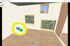
▲Display of 3D Icon
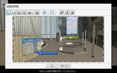
▲Annotation Function
▲Landscape Evaluation Function
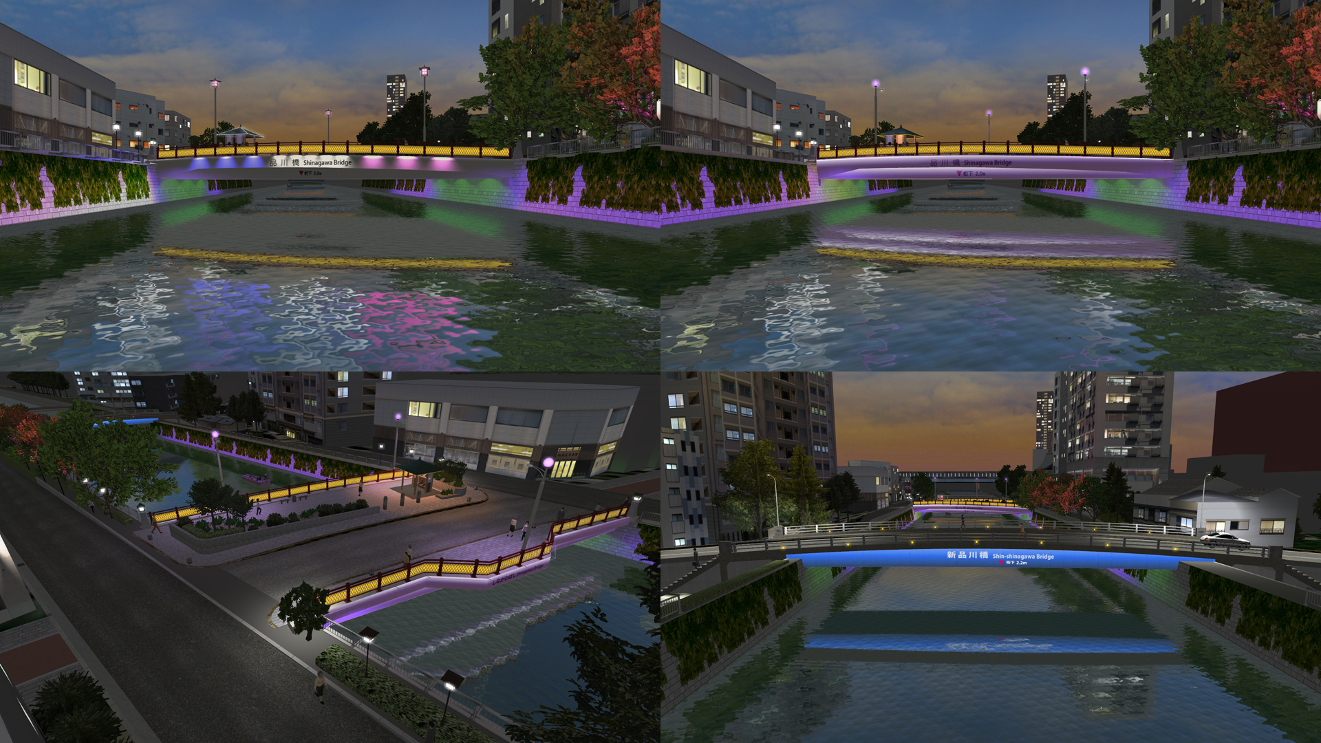
Case Study "Shigeru Mizuki Road x VR-Cloud Ver6.1"
Provided by Tomohiro Fukuda laboratory of environment and energy engineering, Graduate school of Osaka University
With the renewal of Shigeru Mizuki road in Skaiminato City as an example, a VR scenario was created to enable proper consensus on the appropriate method of construction and design proposals.