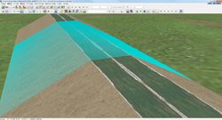
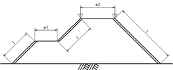
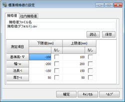
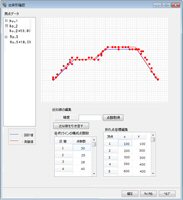
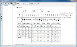
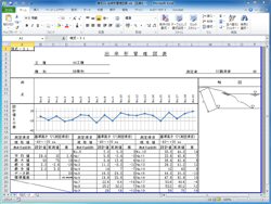
| This product operates as a plug-in of UC-win/Road, the difference is measured from the design data (designed value) and the point cloud data (actual measurement value) and each type of report on the work progress control is created. If the design data has already been maintained with LandXML etc., the work progress control report can be made easily by acquiring the work progress in 3D laser sccanning. It is possible to manage the work progress in an efficient way by comparing and checking (Figure 1) the position from the embankment surface (earth cut surface) designed beforehand in 3DVR.
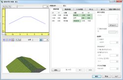
Steps of the work The tool menu of the main body of Road is extended by installing this plug-in, and a special menu has been added. About difference calculation The work flow from the acquisition of design section to the aquisition of measured data is an automatic process, so the work progress control report can be made in an efficient way. |