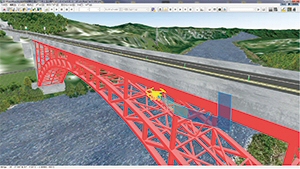
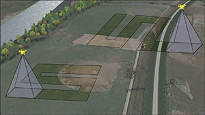
Display of camera contents in 3D environment is planned, for example, the real-time display of recorded range. This feature is sometimes useful when mapping, enabling users to find out uncovered range in real time and to set flight until covering entire mapping area.
Manage multiple UAVs
Until now, it was assumed that one UAV would fly at a time, but it is difficult to cover a wide range with a single UAV in a relatively short time. Wherein, by allocating tasks to multiple UAVs, each UAV can perform mapping the area in charge. The progress can be monitored in UC-win/Road in real time.
In addition, major transportation companies are investigating the actual possibility of sending small packages with UAV, and there is a good chance that UAV will contribute to it in the near future. However, safety issue is standing over if actually using UAV. To solve this problem, UAV batch management system is effective, and it can be used, for example, to evaluate algorithm of flight collision.
 |
 |
and its task allocation |

