UC-win/Road Ver.6.01.00 (Release March 8, 2012)
 |
|
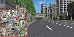
- World file is a file with coordinates information standardized to give coordinates information to the street map (map images of the satellite photograph and the aerial photograph, etc.). By importing the street map together with World file, the street map will be automatically placed on top of the specific geographic location written in the World file.
| Line |
Explanation |
| 1 |
X scale ( Length(m) of each pixel along the X axis) |
| 2 |
Rotation angle in X direction |
| 3 |
Rotation angle in Y direction |
| 4 |
Minus Y scale ( Length(m) of each pixel along the Y axis) |
| 5 |
East longitude coordinates on the center of the pixel in the upper left
corner of the image file. |
| 6 |
North latitude coordinates on the center of the pixel in the upper left corner of the image file. |
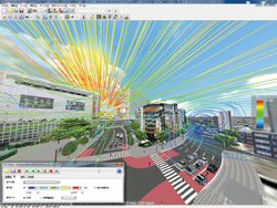
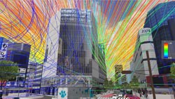
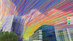
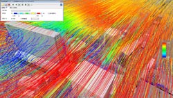
- This plug-in is used to import a file in VTK format and visualize the stream line in the data used by the VTK format. The VTK format is a general format, so it's used for various software.
|
Munsell Color Space Output Plug-in (Price on application) |
|
- Munsell Color Space Output Plug-in is a plug-in which visualizes the spectacle
displayed on the main screen of UC-win/Road in "Munsell color system"
and saves it as munsell color file. This style of expression is often used
in the field of design and art. You can design the spectacle using munsell
color or do a research on munsell color by accessing the file that has
been output using this plug-in.
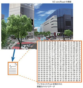 |
| Output image of munsell color file |
|
Legion Plug-in (Price on application) |
|
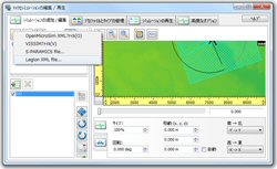
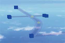
- Legion plug-in is a plug-in used to visualize analysis result of LEGION
STUDIO, a software developed by a British company called Legion that simulates
crowd movement. Legion accurately simulates the movement of pedestrians
(entities) in a spatial area and then analyzes evacuation time, assess
risks, and creates hazard map that can be utilized in the event of an emergency.
 |
 |
| Importing Legion file |
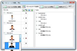
Setting of a profile and type |
 |
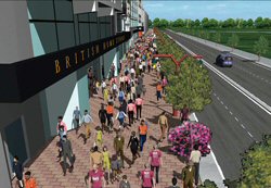 |
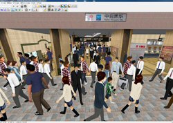
Visualization example
of crowd simulation in a station |
Crowd analysis result's linkage
with micro simulation player |
|
|
UC-win/Road Ver.6.00.02 (Released December 14th, 2011)
|
|
Related Information UC-win/Road Ver.6 (Up&Coming '11 Late Fall Issue)
|
Pedestrians' Movement as a Crowd |
|
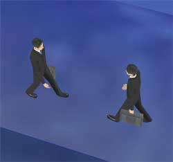
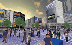
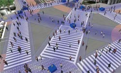
- This is the function of crowd simulation considering avoidance of collision between pedestrians. Many pedestrians' behavior at intersections and in other places can be visualized.
-Improvement in reality
- -Significant reduction in time required to place pedestrians
 |
|
 |
| Avoidance behavior of pedestrians |
|
Pathway |
 |
|
 |
|
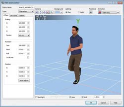
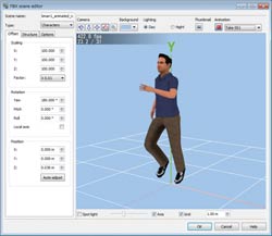
Expansion of support for FBX 3D model |
|
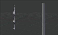
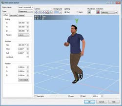
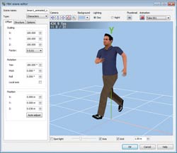
- Supported file format has been expanded. Animation function was added to FBX
file which can support various types of highly precise models.
-Natural movement of joint
-Save characters
-Use with scenario function
 |
|
 |
| Example of animation using bone |
 |
 |
 |
 |
| High performance shader implementation |
| File format |
Version |
| Autodesk AutoCAD DXF (.dxf) |
Version 13 and earlier. |
| Collada DAE (.dae) |
Version 1.5 and earlier. |
| 3D Studio 3DS (.3ds) |
All versions. |
| Alias OBJ (.obj) |
All versions. |
|
Linkage with tsunami analysis software |
|
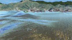
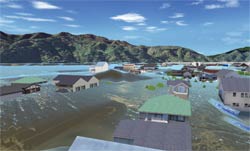
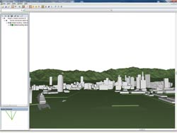
- Result of analysis by flood analysis software "xpswmm" can be visualized in UC-win/Road.
-Improvement in visualization
- -Level of devastation in buildings by tsunami can be visualized.
|
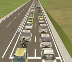
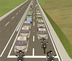
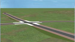
Improvement in realism for traffic simulation |
|
- -Improvement in lane keeping assistance algorithm
|
Expansion of data linkage |
|
- Supports IFC file : import/export terrain, export 3D model
 |
|
 |
| Shows screen of UC-win/Road and the result of exporting data in IFC format |
- Data linkage with 12d Model of 12D Solution Pty Ltd.
-Bidirectional conversion of terrain and road alignment
-Import of road section
 |
| Result of importing 12d Ascii File |
- Plugin for loading parking model
-Import parking drawing data created by Parking Drawing system
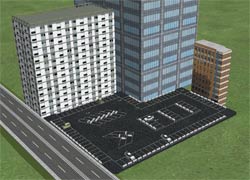 |
| Display example of parking lot model |
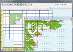
- Supports 5m mesh terrain : Digital map in 5m mesh (elevation) issued by
Geospatial Information Authority of Japan is supported.
 |
|
 |
|
 |
| Lem selection screen |
|
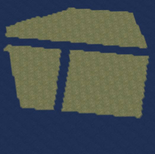
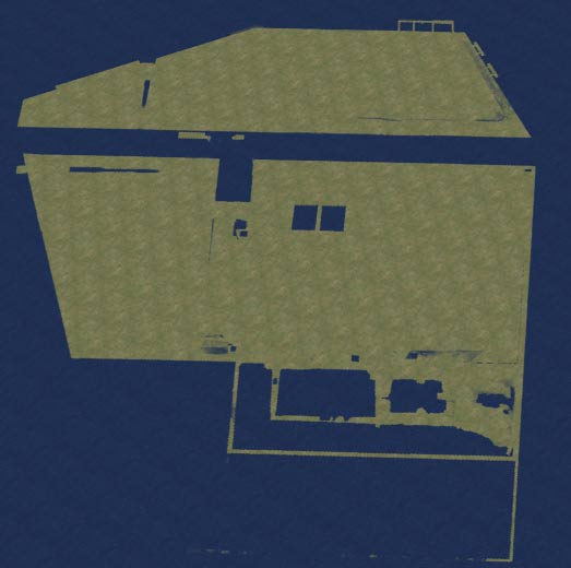
Comparison between 50m mesh (left) and 5m mesh (right) |
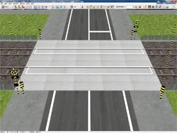
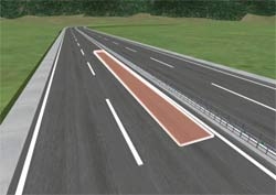
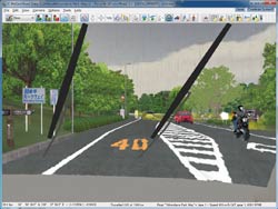
- Force feedback
-Automatic vibration deriving from road material and road shape
-Vibration area: Reproduction of constant vibration within the area
 |
|
 |
| Setting bumps on railroad crossing |
|
Vibration area |
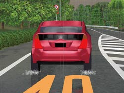
- Improvement in sound of tire
-Slip ratio: Slipping sound in accordance with vehicle speed
- Sound of each of the 4 wheels can be played separately
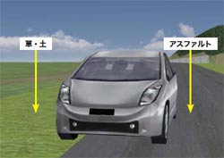 |
Sound produced when running on grass,
soil, asphalt can be played |
- Sample plug-in for visualization of car navigation was added to UC-win/Road SDK
<Application area>
- -Car navigation research
- -System for exhibition
|
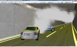
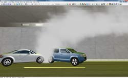
Improvement of smoke function |
|
- The function was improved to simulate the behavior of smoke particles considering temperature, air density, wind etc. more realistically.
It's possible to do simulation inside a tunnel only as you can set passage for smoke.
 |
|
 |
| Display splashing water |
|
Display windshield wipers |
- This is the plug-in which displays the list of information of object (building and tree), texture, intersection etc. in a tree format.
-Verification of total number of pixels in a texture
-Verification of unconnected road connection point
-Verification of buried model
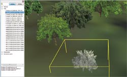 |
| Result of verification on buried model |
|
Revision on option/plug-in |
|
|
|