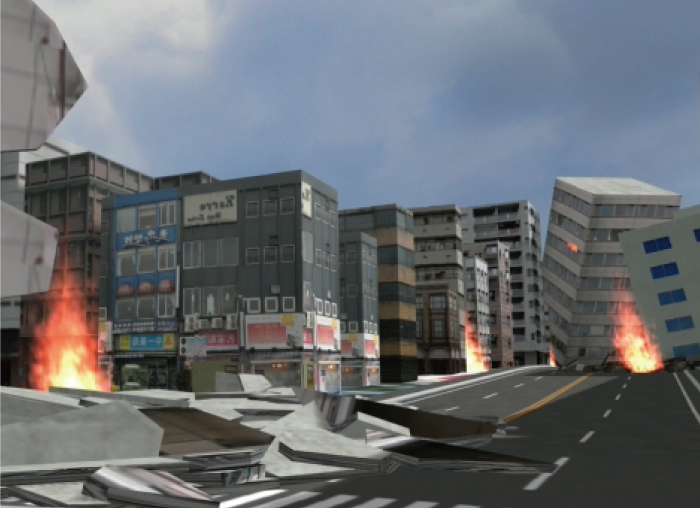
Building and providing a flood hazard map by 3D VR simulation linked with analysis results of inundation /flooding, evacuation /traffic, etc.
- Service launch:'20.11/ Price:Require separate estimation
Overview of the service
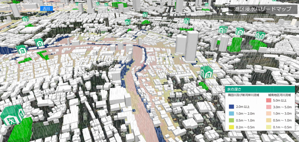
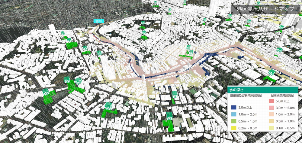
We provide a "3D VR flood hazard map service" that allows you to check simulations and evacuation routes in 3D during a disaster.
Using flat maps for hazard maps as in the past had the problem of being difficult to grasp intuitively, but we built a 3D VR from a flat map and visualized it in cooperation with our high-precision real-time simulation of inundation and tsunami. By doing so, it has become possible to create an easy-to-understand evacuation guidance explanation, and it can be effectively used in disaster prevention education and evacuation drills.
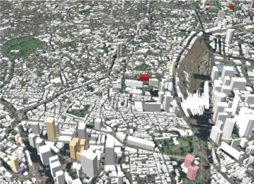
The created data can be viewed on VR-Cloud® and UC-win/Road Free Viewer Version. You can confirm the overall bird's-eye view, the actual location of the evacuation site, and the state before and after the inundation with the walkthrough and from various viewpoints.
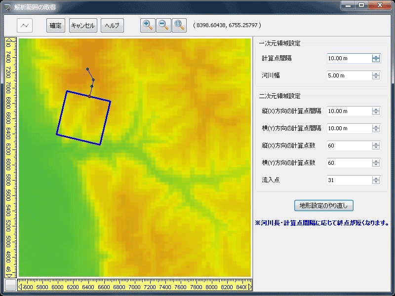
Example of creating the data
<Contents>
●Model and texture creation
- Shelter mark texture, model creation
- Box model integration work
- Water level model creation, texture adjustment
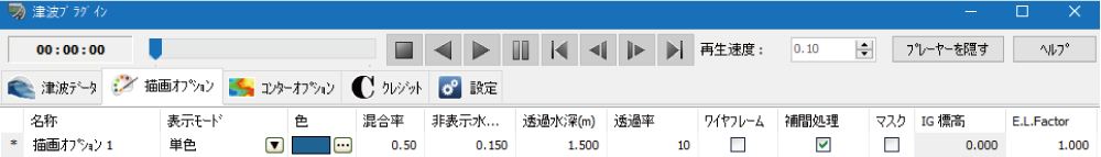
●Settings
- Adding landscape perspective
- Context settings
- Display switching settings
- Script creation
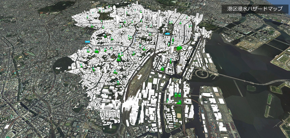
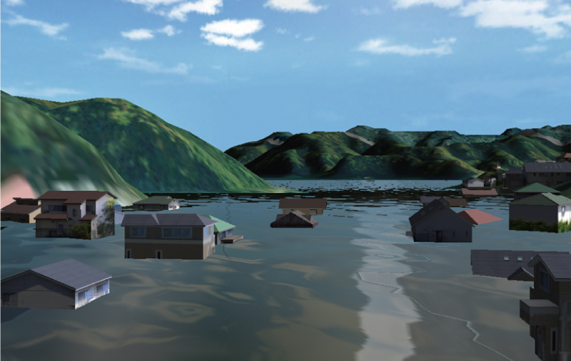
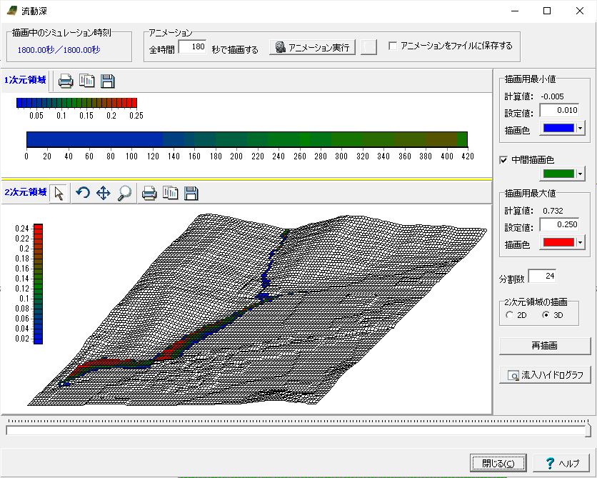
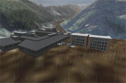
▲Bird's-eye view
▲Water level model
▲Explanation of water level
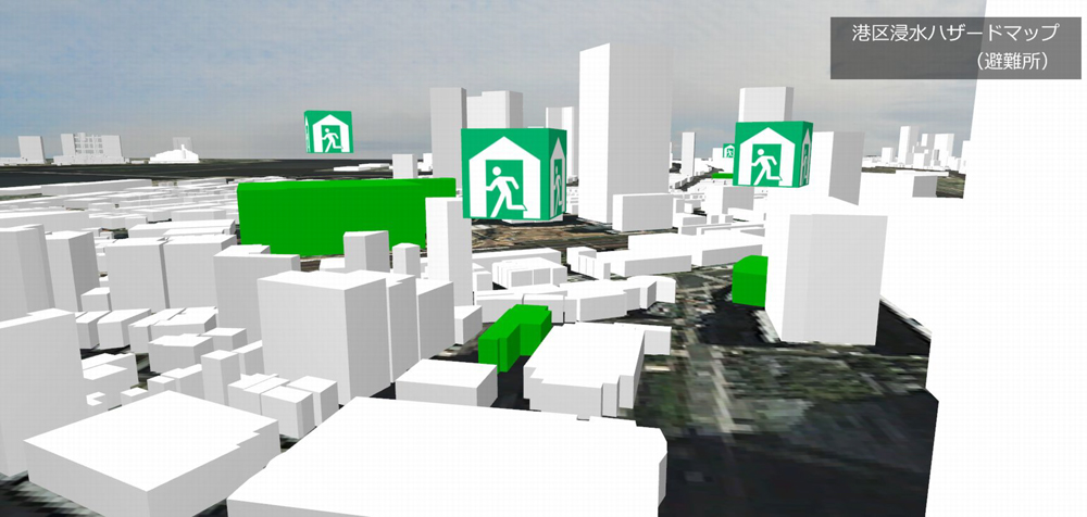
▲Shelter
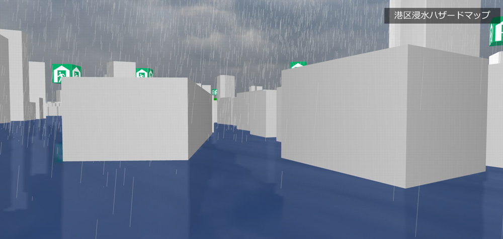
▲When flooded
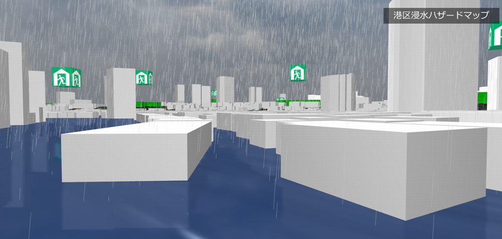
▲When flooded + Water level model
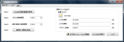
<Example of estimate>
Name of the service |
Price |
|---|---|
| 3D VR flood hazard map (Minato Ward of Tokyo) | ¥683,489 |
The price excludes tax
<Reference>
・Hazard map portal site (Japanese)
・Minato Ward Flood Hazard Map(PDF)
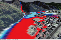
Case examples of 3DVR hazard map
-
The 15th 3D・VR simulation contest Hornable judge award
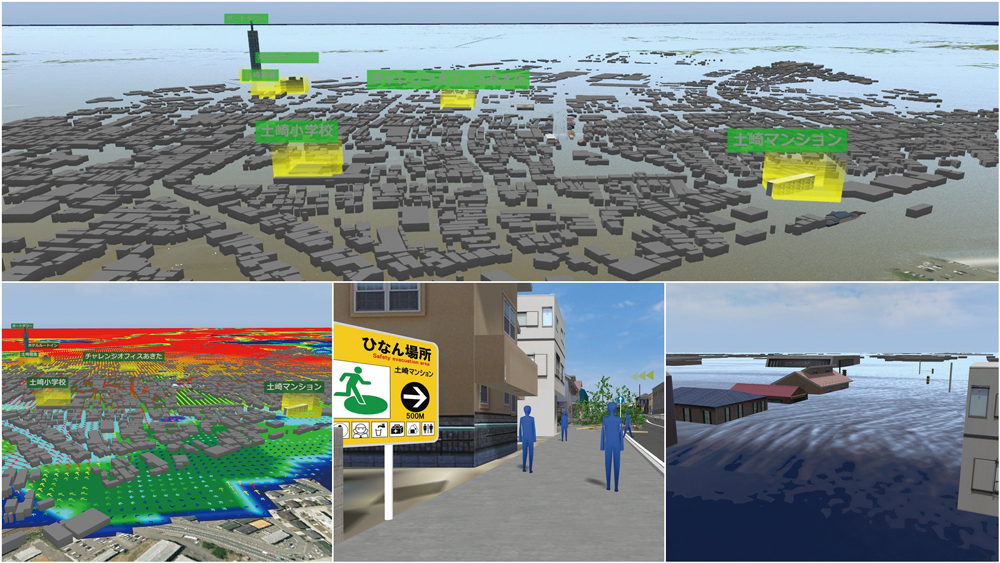
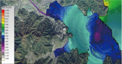
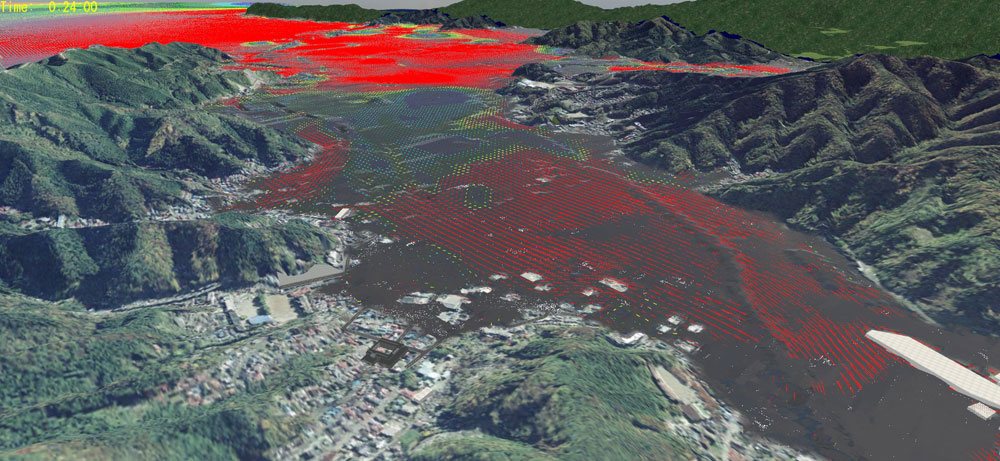
"Education system of rapid evacuation from tsunami" Akita Industrial Technology Center/ Akita UniversityAn evacuation education system that we can learn how to escape rapidly from the area where a tsunami is predicted to come following the seabed earthquake. This system has affinity for residents in Akita city because the cityscape of inundated areas in the city is created in VR and they can experience how tsunami flows up to the city.
The 12th 3D・VR simulation contest Hornable judge award
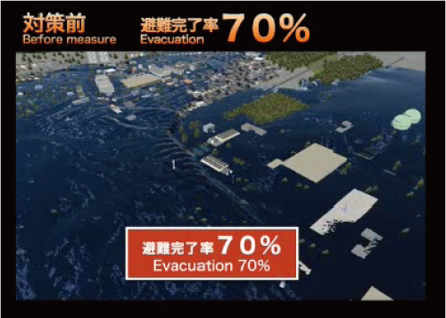
"VR simulation using tsunami/ evacuation analysis results" PACIFIC CONSULTANTS CO.,LTD.The traffic flow and signal control are set, and the change in the landscape from the moving viewpoint is simulated by getting on a traveling vehicle.
The 1st National Resilience Design Award Hornable judge award
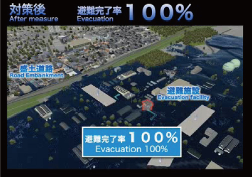
"Inundation analysis at the factory site considering the collapse of a levee breach" Azbil CorporationAccording to the flood hazard map published on the homepage of the local government where the company's factory is located, it is considered that inundation and inundation predictions in the downstream area are excessively occurring assuming the levee collapse due to the flooding of the river in the upstream area. Therefore, they aimed to grasp the inundation situation more accurately by conducting a detailed inundation analysis around the factory site. Furthermore, based on the results of this analysis, it was decided to utilize it for BCP measures at the factory.
Related products/ service
UC-win/Road for Tsunami
-
>>Click here for more information on the product
Tsunami analysis by the difference method of shallow-water theory
The finite difference method of shallow water theory predicts the inundation range and inundation depth of tsunamis that may occur in the future. Evaluate wave force to structures, transport drifting objects, calculate wave height and velocity at each mesh point, and create tsunami height distribution map. We propose a model linked with the research of Tohoku University Tsunami Engineering Laboratory (Professor Fumihiko Imamura).
▲Analysis result by xpswmm
▲Tsunami setting screen
Example of Tsunami analysis
A run-up simulation that predicts the inundation range and inundation depth of the land area for tsunamis that may occur in the future. Evaluate wave force to structures, transport drifting objects, calculate wave height and velocity at each mesh point, and create tsunami height distribution map.
▲VR model that operated the analysis result on UC-win/ Road
Tsunami numerical analysis support service
Using the tsunami analysis code developed by Imamura Laboratory, it is possible to collaborate with UC-win / Road and analysis support services that can be applied to hazard map creation and evacuation prediction related to tsunami. Basic information such as terrain, buildings, trees, etc. is imported from Road data in cooperation, and the calculation result of analysis code is imported into UC-win/ Road for visualization.
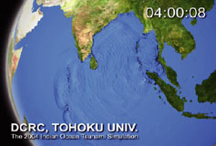
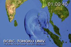
▲ Analysis animation of Indian Ocean tsunami (2004) (Tohoku University Tsunami Engineering Laboratory)
- We exhibited at the International Tsunami Symposium.
(April 10,11th 2010 Tohoku University International Tsunami Symposium)) - A special lecture was given by Professor Fumihiko Imamura of Tohoku University.
"Analysis of Tsunami and Disaster Control"(November 19, 2008 2nd International VR Symposium) -
A special lecture was given by Mr. Kazumitsu Takanashi, Doctor of Engineering, Civil Engineering Business Headquarters, Shimizu Corporation.
"Analysis of Tsunami and Disaster Control"(November 19, 2008 2nd International VR Symposium)
- We exhibited at the International Tsunami Symposium.
Debris flow simulation (Only available in Japanese)
-
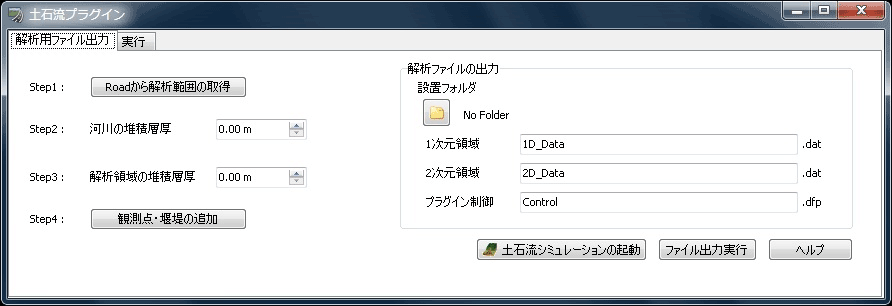
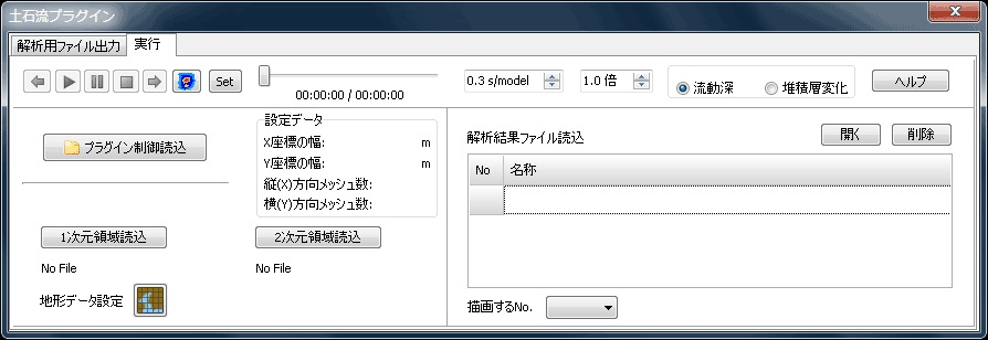
Using the "debris flow simulator (Kanako)" developed by the Graduate School of Agriculture, Kyoto University as a solver, we have prepared a separate pre-section and post section, and can perform debris flow analysis in a series of processes. This system integrates "debris flow simulation" and "UC-win / Road debris flow plug-in" for creating analysis input data and visualizing analysis results.
Screen sample/ Output example/ Analysis example
▲Debris flow simulation plugin
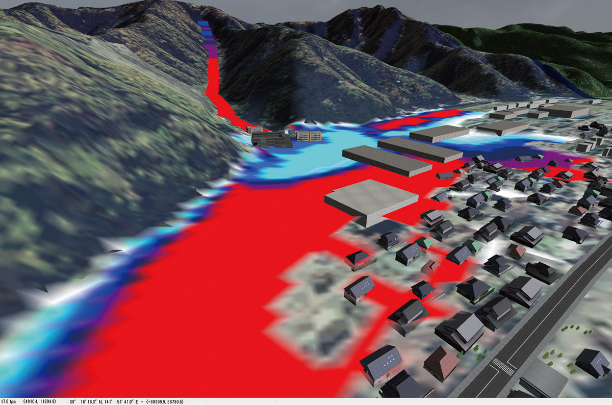
▲Analysis result of flow depth
▲Data export

▲Data visualization
▲Visualization of debris flow analysis results (left: contour is also displayed, right: representation of debris flow)

Road damage information system
-
The road damage information system is a system that collects and provides road damage information occurrence points during normal times and disasters. FORUM8 provides service construction and customization of this system to local governments, road managers, etc.
●Overview of the service
This service allows you to register and view road information in the event of a disaster. If you need to collect road information immediately in the event of a disaster, etc., we can collect and provide the latest road information with the cooperation of the general public.
▲You can collect disaster information
from all over Japan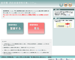
▲Road damage information system registration screen.
You can view and register disaster information
http://iwate.douro-info.net/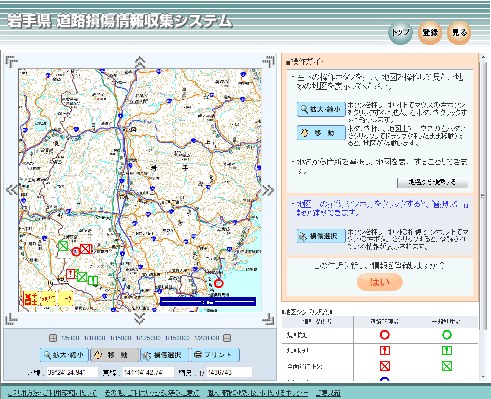
▲Maps and icons make it easy to
understand the disaster situation
▲The administrator can manage the registered
road damage information etc. for each region.Demo site >>www.forum8.co.jp/product/douro-info/
You can browse and operate the road damage information demo sites of Aomori, Iwate, Miyagi, Akita, Yamagata, Fukushima, Ibaraki, and Chiba prefectures.
Disaster simulation system
-
By utilizing UC-win/Road for GIS, GIS standard file Shape files can be imported as 3D cities and roads. You can perform 3D simulations linked with GIS such as floods, evacuation, tsunamis, and architectural plans.
Motion strength map
-
Motion strength map creation service
The motion strength map is one of the earthquake disaster prevention maps introduced by the Cabinet Office, and the map that informs the danger of earthquakes in the area is called the earthquake disaster prevention map. It is considered effective to present an earthquake disaster prevention map as a means of disseminating information to residents.
FORUM8 provides these motion strength maps and other hazard map creation support services. The development is progressing in each local government, and we have a track record of this service.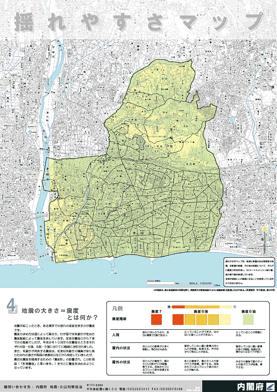
製品価格
本体価格
-
価格は税別表示です
■本体価格
製品名
価格
スイート建設会計 ¥250,000 スイート建設会計 Pro (無償保証5年) ¥600,000 スイート給与計算-出面管理- ¥250,000
※初年度サブスクリプション契約は新規価格に含まれます。
※レンタルライセンスは通常製品同様の提供となります。
※ライセンスは入力無制限ですが、出力はライセンス数のみになります。
サブスクリプションサービス 契約価格
サブスクリプションサービス 契約価格
-
■サポート内容
・バージョンアップ無償提供 ・電話問合せテクニカルサポート
・問合せサポート(電子メール、FAX) ・ダウンロードサービス ・保守情報配信サービス※ライセンス管理コスト削減、製品ご利用形態ニーズ多様化への対応を充実させることを目的として、従来の保守・サポート形態からより便利な、「サブスクリプションサービス」へ順次移行いたします(2016年4月1日~)。
価格は税別表示です
対象製品 初年度 1年 スイート建設会計 無償 ¥100,000 スイート給与計算-出面管理- ¥100,000
レンタルライセンス価格
■レンタルライセンス:短期間での利用により、低廉な価格でのライセンス利用が可能
■レンタルアクセス:既に購入済みの製品の利用ライセンス数を増やす事が可能です。事前契約により、レンタルライセンス期間(1ヵ月~3ヵ月)の単位で自動的にライセンスが付与されます。利用実績に応じて後日請求いたします。事前申込価格として、レンタルライセンス価格の15%引きとなります。ユーザ情報ページにてお申込みいただけます。
※サービス強化、利便性向上を図る目的で「レンタルライセンス」を2007年9月3日より提供を開始しました。
※レンタルライセンス開始後の期間変更は出来ません。期間延長の場合は再申込となります。
レンタルライセンス
-
価格は税別表示です
■レンタルライセンス
対象製品 1ヶ月 2ヶ月 3ヶ月 6ヶ月 スイート建設会計 ¥75,000 ¥100,000 ¥120,000 ¥150,000 スイート給与計算-出面管理- ¥75,000 ¥100,000 ¥120,000 ¥150,000 バージョンアップ開発履歴
-
バージョンアップ開発履歴
-
■バージョンアップ、リビジョンアップ(無償保守)の主な内容を一覧にしています。
旧版改訂、リバイバル版リリース時などの場合にご参考ください。価格は税別表示です
スイート建設会計 バージョン リリース日 主なバージョンアップ内容 1.0.0 18/02/28 新規リリース。
スイート給与計算-出面管理- バージョン リリース日 主なバージョンアップ内容 1.0.0 19/04/01 新規リリース。
建設業ユーザ様向けに、「スイート給与計算」に以下の機能を追加- 人件費の直接費管理が可能(作業現場日数の管理)
- 出面管理(労務日報入力、現場管理、タイムカード機能連動)
-
動作環境
動作環境
-
対応OS(推奨ブラウザ等) 推奨ブラウザ:Internet Explorer 11、Microsoft Edge(最新版)、Google Chrome(最新版)
対応OS:上記ブラウザの対応OS推奨環境 CPU、メモリおよび必要ディスク容量:上記ブラウザの動作環境に準ずる
ディスプレイ解像度:SXGA(1280×1024)以上
製品購入/お問い合わせ窓口
製品購入/お問い合わせ窓口
-
■FORUM8 オーダーページで購入
製品購入 - オーダーページ にて、バージョンアップ・新規製品・各種サービスの御見積作成・申込・決済ができます。
クレジット利用や、分割払いシステムでの購入も可能です。
ご質問は、バージョンアップセンタ(vc@forum8.co.jp)までお気軽にお問い合わせ下さい。
