International Newsletter vol.31 2010/4
4.30.2010 FORUM8 Co., Ltd
--------New product Introduction--------
-UC-win/Road Highway Driving Simulator
-UC-win/Road S-PARAMICS Plug-in
-------Conferences, training and seminars
-Upcoming conference introduced
-Seminar schedule in Shanghai and Seoul is announced below
Tell your colleagues and acquaintances to become a subscriber. Application form.
| UC-win/Road Highway driving simulator | |||||||||||||||||||||||||||||||||||||||||||||||||||||||||
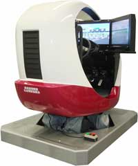
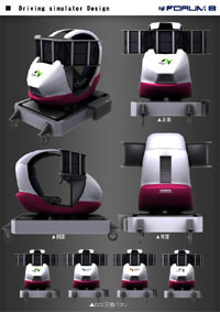
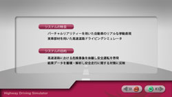
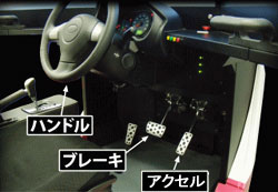
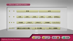
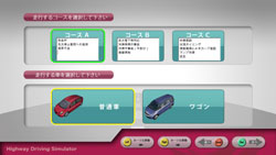
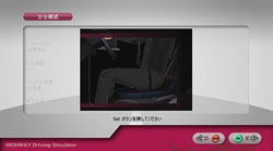
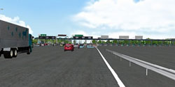
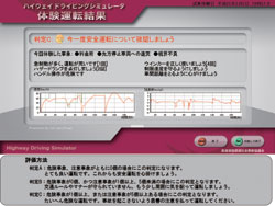
| Example case of UC-win/Road Experience Simulator Convention on Social Contribution of Highway: Highway Driving Simulator Technical support by: NEXCO East Japan (East Nippon Expressway)
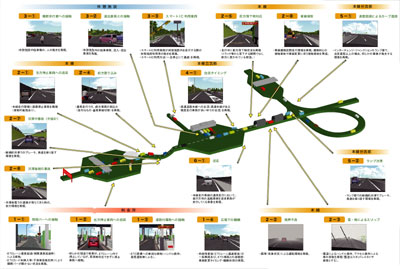
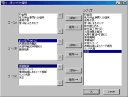
3 scenarios available: combination of 19 hazardous events on highway lane, exit and etc. Events set for the experience driving
Menu
|
|||||||||||||||||||||||||||||||||||||||||||||||||||||||||
| UC-win/Road for S-PARAMICS |
| S-PARAMICS plug-in is the new option for UC-win/Road to link with S-PARAMICS, a leading traffic microsimulation software Related option : UC-win/Road Micro Simulation Player Plug-in option |
||
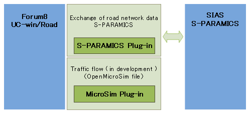
| S-PARAMICS Plug-in Option enables data exchange between UC-win/Road and S-PARAMICS to provide a great combination of traffic analysis and
3D virtual reality by linking one of the leading traffic microsimulation
solutions with UC-win/Road. We will continue to develop this plug-in. Here, we introduce the road network exchange function.
|
||
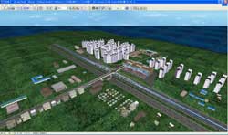
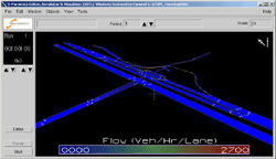
S-PARAMICS and UC-win/Road can share the same road network information by exchanging geometric data of the road. S-PARAMICS/OpenMicroSim Conversion Tool (under development) enables you to visualize the simulation result of S-PARAMICS, and the S-PARAMICS plug-in can then be used to maintain the positions of the vehicles and the roads. Virtual reality environment of UC-win/Road can be used to visualize landscapes, road designs and traffic as well as to check road conditions from the driver's viewpoint on our state-of-the-art Drive Simulator. In addition, this plug-in option can be used for high quality traffic simulation. The amount of work can be greatly reduced by converting the road network data created in UC-win/Road and using it in S_PARAMICS for simulation. We envisage that the reciprocal data exchange between VR and traffic analysis will create an ideal combination between the comprehensive visualization and the state-of-the-art technology to help improve the road conditions and the traffic. Due to the difference in data format for road networks in traffic simulation and in Virtual Reality, data conversion is required. S-PARAMICS does not require as much information about roads for simulating traffic as UC-win/Road does. Therefore, it is more practical to carry out detailed settings on the road after the data is imported into UC-win/Road from S-PARAMICS. On the other hand, detailed traffic settings, including connection points, must be carried out after importing data from UC-win/Road to S-PARAMICS. This plug-in option is design to minimize the work load by exchanging data. Details of data exchange are described below.
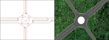
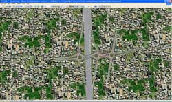
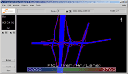
Node with attributes for roundabout is represented in UC-win/Road. It also shows the alteration in cross section on the right hand side of the intersection.
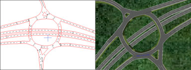
In S-PARAMICS, roundabouts are often set up with multiple connections, and in UC-win/Road, they are represented as series of intersections. Since the height data is added the original data, UC-win/Road enables you to set the longitudinal alignment. Roads passing below the roundabouts are automatically set as tunnels.
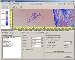
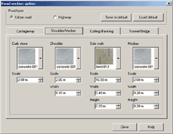
The data to be imported can be viewed easily. The parameters for import and the textures of the cross section can also be chosen.
|
||||||||||||||||||||||||||||||||||||||||
| >> Collaboration news : SIAS Limited, U.K. (Up&Coming 2010 New year special issue) SIAS has been providing expertise and technologies concerning a wide range of issues related to transport planning for more than 30 years. Its main clients are central and local governments, their agencies, and private sector developers. SIAS was the first company in the UK to adopt microsimulation, developing its own software for the market SIAS was set up in Edinburgh, the capital of Scotland in 1974, as a branch office to perform transport-planning consultancy. SIAS was using CDC6600, then the highest performance computer available in Europe. In 1988, the current organization was formed. Since then, SIAS opened offices in Perth and Glasgow in Scotland, and London and Birmingham in England. In 1990s, OBE(Order of the British Empire) was given to its managing director for SIAS’S long contribution to develop traffic simulation and planning method. The Company's core activity is transport planning. SIAS's Paramics Microsimulation division has developed a widely applicable traffic flow modeling system in response to the demand of transport planning markets in the world over. S-Paramics is the latest version of the software for the analysis and design of such urban and highway networks. S-Paramics offers wide area modeling with high accuracy, such as tiered dynamic route choice for robust routing in large networks, with links to ITS and UTC systems. S-Paramics can also model transit operations with user defined scheduling and bus stop loading. S-Paramics is highly respected by traffic planners and modelers throughout the world as the most versatile and comprehensive road traffic flow analysis system. The traffic flow analysis includes road planning evaluation proposed by Scotland Transport Authority and NESA ("Network Evaluation from Surveys and Assignment” which was developed to estimate the impact on traffic and economic activities. NESA was first introduced in 1978, has become an important tool to evaluate the transportation by Scotland Transport authority and the economy today. |
||
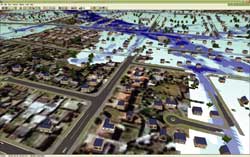
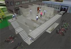
| UC-win/Road disaster and security solutions |
|
| Up coming conference and trade shows |
FORUM 8 will participate following conference
ITS America 20th Annual Meeting and Exposition
Houston May3-5, 2010
http://registration.experient-inc.com/ShowITS102/Default.aspx
| Overseas Training and Seminars |
Seminars in Shanghai will be held on the following schedule.
Venue:
Shanghai - Shanghai Seminar room (FORUM8 Technology Development(Shanghai) Co., Ltd)
| Seminar | Date | City |
| UC-win/Road VR | May 4th, 2010 | Seoul |
| May 25th, 2010 | Shanghai | |
| UC-win/Road Advanced | May 18th, 2010 | Seoul |
| Engineer's Studio, UC-win/FRAME (3D) |
June 3rd, 2010 | Shanghai |
| GeoFEAS | May 6th, 2010 | Seoul |
| Temporary sheathing work design (Korean stnadard) | May 27th, 2010 | Seoul |
| Summary | ||
| Participation Fee | Free | |
For more information and applications, please email us at
Gross circulation: 4045
To subscribe this page, go to http://www.forum8.co.jp/english/p-mail-e.htm
If you would like to unsubscribe from our newsletters, please include "Unsubscribe"
in the subject title of your email and send it back to us.
Thank you for your continued support.
FORUM8 Co., Ltd. mailto:forum8@forum8.co.jp
2-1-1 Nakamegruro GT Tower 15F
Kamimeguro Meguro-ku Tokyo 153-0051 JAPAN
TEL +81-3-5773-1888
FAX +81-3-5720-5688
http://www.forum8.co.jp/english/index.html
